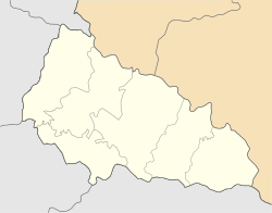
Kamianske, Zakarpattia Oblast
Appearance
Kamianske
Кам'янське | |
|---|---|
| Coordinates: 48°16′00″N 22°57′00″E / 48.26667°N 22.95000°E | |
| Country | |
| Oblast | |
| Raions | Berehove Raion |
| Elevation | 135 m (443 ft) |
| Population | |
| • Total | 1,482 (2,021 census) |
 | |
Kamianske is a locality in western Ukraine. It is in the Berehove Raion of the Zakarpattia Oblast, but formerly administered as part of Irshava Raion. Kamyanske is also known as Kam'yans'ke (Ukrainian), Beregkövesd (Hungarian), Kivjažď (Slovakian), Kamenskoye (Russian), Kamenka, Kivyazhd, Kamjanske, and Szilicekövesd.[1]
It was formerly part of Czechoslovakia until 1945.
References
[edit]External links
[edit]


