Kalanchak
Kalanchak | |
|---|---|
 | |
| Coordinates: 46°15′08″N 33°17′26″E / 46.25222°N 33.29056°E | |
| Country | |
| Oblast | Kherson Oblast |
| Raion | Skadovsk Raion |
| Hromada | Kalanchak settlement hromada |
| Area | |
• Total | 21.706 km2 (8.381 sq mi) |
| Population (2022) | |
• Total | |
| Postal code | 75800 |
| Area code | +380-5530 |
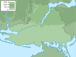
Kalanchak (Ukrainian: Каланчак) is a rural settlement in Skadovsk Raion, Kherson Oblast, southern Ukraine.[1] It hosts the administration of the Kalanchak settlement hromada, one of the hromadas of Ukraine.[2] It has a population of 8,977 (2022 estimate).[3]
History
[edit]Until 18 July, 2020, Kalanchak was the administrative center of Kalanchak Raion. The raion was abolished in July 2020 as part of the administrative reform of Ukraine, which reduced the number of raions of Kherson Oblast to five. The area of Kalanchak Raion was merged into Skadovsk Raion.[4][5]
Until 26 January 2024, Kalanchak was designated urban-type settlement. On this day, a new law entered into force which abolished this status, and Kalanchak became a rural settlement.[6]
History
[edit]This section needs expansion. You can help by adding to it. (July 2022) |
In the Middle Ages, there was a fortification referred to as kale-kucuk (small fortress in Crimean Tatar). The settlement was founded in 1794 as a home for exiled participants in the Turbai uprising.[7] Kalanchak became the site of the first attack on Ukraine during the Russian invasion of Ukraine, when Russian soldiers attacked an outpost in the town.[8]
Transportation
[edit]Kalanchak railway station is located in Myrne approximately 10 kilometres (6.2 mi) east of the settlement. It is on the railway which used to connect Kherson with Dzhankoi; however, after the Russian annexation of Crimea in 2014, the trains only run as far as Vadym, close to the border with Crimea. There is infrequent passenger traffic.
The settlement has access to Highway M17, which runs north to Kherson and south to the border with Crimea.
See also
[edit]References
[edit]- ^ "Главная страница Каланчацька селищна рада". kalanrada.ks.ua. Archived from the original on 2016-03-05. Retrieved 2016-11-13.
- ^ "Каланчацкая громада" (in Russian). Портал об'єднаних громад України.
- ^ Чисельність наявного населення України на 1 січня 2022 [Number of Present Population of Ukraine, as of January 1, 2022] (PDF) (in Ukrainian and English). Kyiv: State Statistics Service of Ukraine. Archived (PDF) from the original on 4 July 2022.
- ^ "Про утворення та ліквідацію районів. Постанова Верховної Ради України № 807-ІХ". Голос України (in Ukrainian). 2020-07-18. Retrieved 2020-10-03.
- ^ "Нові райони: карти + склад" (in Ukrainian). Міністерство розвитку громад та територій України.
- ^ "Что изменится в Украине с 1 января". glavnoe.in.ua (in Russian). 1 January 2024.
- ^ Volodymyr Kubijovyc (26 May 2016). Encyclopedia of Ukraine: Volume II: G-K. University of Toronto Press, Scholarly Publishing Division. p. 1169. ISBN 978-1-4426-5118-0.
- ^ "Ukraine-Russia conflict: First pictures from ground zero". WION. Retrieved 2022-08-10.


