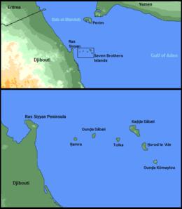
Kaḏḏa Dâbali
Appearance
 Kaḏḏa Dâbali Island Map | |
 | |
| Geography | |
|---|---|
| Location | Red Sea |
| Coordinates | 12°28′16″N 43°25′48″E / 12.471°N 43.430°E |
| Archipelago | Seven Brothers |
| Highest elevation | 114 m (374 ft) |
Kaḏḏa Dâbali Island, often called Big Island (Modern Arabic: الجزيرة الكبرى), is an uninhabited rocky island off the coast of Obock Region of Djibouti in the Bab-el-Mandeb strait (between the Red Sea and the Gulf of Aden). It is the largest one of the Seven Brothers Islands.[1]
References
[edit]- ^ "Kaḏḏa Dâbali: Djibouti". National Geospatial-Intelligence Agency, Bethesda, MD, USA. Retrieved November 11, 2012.
