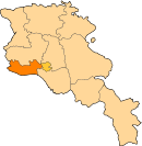
Jrarat, Armavir
Appearance
40°04′17″N 44°15′47″E / 40.07139°N 44.26306°E
Jrarat
Ջրառատ | |
|---|---|
| Coordinates: 40°04′17″N 44°15′47″E / 40.07139°N 44.26306°E | |
| Country | Armenia |
| Marz (Province) | Armavir |
| Population (2011) | |
• Total | 2,981[1] |
| Time zone | UTC+4 ( ) |
Jrarat (Armenian: Ջրառատ) formerly known as Gharkhun or Verin Gharkhun, is a village in the Armavir Province of Armenia. It has a large poultry industry and nearby is a piece of land reserved for the cochineal dye beetles, Porphyrophora hamelii.[2]
Jrarat has a population of 2,981 at the 2011 census.[1]
In addition to the 2,981 people in the town, the Jrarrat Poultry Farm has an additional 1,165 residents (2001 census) in its workers' housing, bringing the population of the area to 4,000.
See also
[edit]References
[edit]- ^ a b "Armavir (Armenia): Towns and Villages in Municipalities". www.citypopulation.de. Retrieved 2024-11-08.
- ^ Kiesling, Rediscovering Armenia, p. 40, available online at the US embassy to Armenia's website Archived 2008-06-26 at the Wayback Machine
- Jrarat, Armavir at GEOnet Names Server
- World Gazetteer: Armenia[dead link] – World-Gazetteer.com
- Report of the results of the 2001 Armenian Census, Statistical Committee of Armenia
- Kiesling, Brady (June 2000). Rediscovering Armenia: An Archaeological/Touristic Gazetteer and Map Set for the Historical Monuments of Armenia (PDF). Archived (PDF) from the original on 6 November 2021.


