Johnson, Arizona
Appearance
Johnson, Arizona | |
|---|---|
| Coordinates: 32°06′11″N 110°03′58″W / 32.10306°N 110.06611°W | |
| Country | United States |
| State | Arizona |
| County | Cochise |
| Elevation | 4,977 ft (1,517 m) |
| Time zone | UTC-7 (Mountain (MST)) |
| • Summer (DST) | UTC-7 (MST) |
| Area code | 520 |
| FIPS code | 04-36360 |
| GNIS feature ID | 6470[1] |
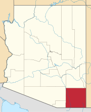
Johnson is a populated place situated in Cochise County, Arizona, United States, on the east side of the Little Dragoon Mountains.[2]
History
[edit]The location began as a mining camp, and a post office was established there in 1900, with William De H. Washington as its postmaster.[3] The post office closed in 1929.[4]
Johnson's population was 317 in 1902.[5]
References
[edit]- ^ a b U.S. Geological Survey Geographic Names Information System: Johnson, Arizona
- ^ "Johnson (in Cochise County, AZ) Populated Place Profile". AZ Hometown Locator. Retrieved November 30, 2016.
- ^ Barnes, Will Croft (2016). Arizona Place Names. Tucson: Arizona Place Names. p. 226. ISBN 978-0816534951.
- ^ "Post Offices, Arizona:Cochise County". postalhistory.com. Archived from the original on December 1, 2016. Retrieved November 30, 2016.
- ^ Cram's Modern Atlas: The New Unrivaled New Census Edition. J. R. Gray & Company. 1902. pp. 203–207.


