Jharkhand Dham
This article needs additional citations for verification. (December 2020) |
| Jharkhand Dham | |
|---|---|
 Jharkhand Dham Shiva Temple | |
| Religion | |
| Affiliation | Hinduism |
| District | Giridih |
| Deity | Shiva |
| Festivals | Maha Shivaratri |
| Location | |
| Location | Dhanwar |
| State | Jharkhand |
| Country | |
| Geographic coordinates | 24°20′02″N 86°01′4″E / 24.33389°N 86.01778°E |
| Architecture | |
| Type | Hindu temple architecture |
| Temple(s) | 10 |
Jharkhand Dham (also known as Jharkhandi) is a temple of the Hindu god Shiva and pilgrimage center near Dhanwar in Giridih District, Jharkhand, India.
Geography
[edit]
10miles
Dham
River
River
M: municipality, CT: census town, R: rural/ urban centre, H: historical/ religious/ tourist centre
Owing to space constraints in the small map, the actual locations in a larger map may vary slightly
Location
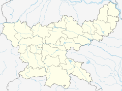
[edit]Jharkhand Dham is located at 24°20′02″N 86°01′4″E / 24.33389°N 86.01778°E.
It is approximately 55 km from Giridih and 10 km from Rajdhanwar.[1] Note: The map alongside presents some of the notable locations in the district. All places marked in the map are linked in the larger full screen map.
There is a temple to Shiva, where an annual fair takes place.[2]
On the southwest side of temple is the Irga river.[citation needed]
Education
[edit]Sanskrit Hindi Vidyapith was established at Jharkhanddham, Giridih, in 1967. It is an institute specializing in Sanskrit, but also offers other courses. It is affiliated to Vinoba Bhave University. It has hostel facilities.[3][4]
References
[edit]- ^ "Jharkhand Dham, Giridih". Tripadvisor. Retrieved 2021-11-23.
- ^ "Parasnath | Giridih Tourism Place". parasnath.nic.in. Archived from the original on 2021-11-23. Retrieved 2021-11-23.
- ^ "Sanskrit Hindi Vidyapith". way2college. Retrieved 2 December 2017.[permanent dead link]
- ^ "Sanskrit Hindi Vidyapith". ICBSE. Retrieved 2 December 2017.

