Jászfelsőszentgyörgy
Appearance
(Redirected from Jaszfelsoszentgyoergy)
You can help expand this article with text translated from the corresponding article in Hungarian. (December 2013) Click [show] for important translation instructions.
|
Jászfelsőszentgyörgy | |
|---|---|
Village | |
| Coordinates: 47°30′32″N 19°47′26″E / 47.50889°N 19.79056°E | |
| Country | |
| County | Jász-Nagykun-Szolnok |
| District | Jászberény |
| Area | |
| • Total | 39.28 km2 (15.17 sq mi) |
| Population (2013) | |
| • Total | 1,905 |
| • Density | 48.5/km2 (126/sq mi) |
| Time zone | UTC+1 (CET) |
| • Summer (DST) | UTC+2 (CEST) |
| Postal code | 5111 |
| Area code(s) | (+36) 57 |
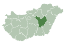
Jászfelsőszentgyörgy is a village in Jász-Nagykun-Szolnok county,[1] in the Northern Great Plain region of central Hungary.
Geography
[edit]It covers an area of 39.28 km2 (15 sq mi) and has a population of 1,905 people (2013 estimate).[2] It lies on the right side of the Zagyva river in the Jász-Nagykun-Szolnok county's northwestern region.
Public Life
[edit]Mayors
- 1990–1994: Ménkű Miklós (independent) [3]
- 1994–1998: Ménkű Miklós (independent) [4]
- 1998–2002: Ménkű Miklós (independent) [5]
- 2002–2006: Rimóczi Sándor (independent) [6]
- 2006–2010: Zelenai Tibor Károlyné (independent) [7]
- 2010–2014: Zelenai Tibor Károlyné (independent) [8]
- 2014–2019: Zelenai Tibor Károlyné (independent) [9]
- 2019-present: Zelenai Tibor Károlyné (Fidesz-KDNP) [10]
Population
[edit]| Year | 1980 | 1990 | 2001 | 2010 | 2011 | 2013 |
|---|---|---|---|---|---|---|
| Population | 1,967 (census)[2] | 1,831 (census)[2] | 1,803 (census)[2] | 1,939 (estimate)[11] | 1,921 (census)[2] | 1,905 (estimate)[2] |
Trivia
[edit]Jászfelsőszentgyörgy is the longest name of a city or village in Hungary.
References
[edit]- ^ "Jászfelsőszentgyörgy City Info". CitySeek.org. Retrieved 9 December 2013.
- ^ a b c d e f "Jászfelsőszentgyörgy Population Table". citypopulation.de. Retrieved 9 December 2013.
- ^ https://static.valasztas.hu/letoltesek/valasztasi_eredmenyek_1990-2019.tar [bare URL]
- ^ "Teljkv".
- ^ "Teljkv".
- ^ "Teljkv".
- ^ "Teljkv".
- ^ https://static.valasztas.hu/dyn/ov10/outroot/onktjk3/11/tjk11019.htm [bare URL]
- ^ "Evkjkv1".
- ^ "Település adatlap".
- ^ "Helységnévkönyv adattár 2010". KSH (Hungarian Central Statisctical Office). 1 January 2010. Archived from the original on 7 November 2012. Retrieved 9 December 2013.
External links
[edit]- Official site in Hungarian


