Jantroon Dhar
This article needs additional citations for verification. (January 2020) |
| Jantroon Dhar | |
|---|---|
| Jantroon Top | |
 A meadow of Jantroon in June 2020 | |
| Length | 7 mi (11 km) |
| Width | 1.5 mi (2.4 km) |
| Geography | |
| State/Province | Chenab Valley, Jammu and Kashmir |
| District | Doda |
| Population center | Thathri |
| Borders on | |
| Coordinates | 33°05′38″N 75°46′23″E / 33.093881°N 75.773008°E |
| Mountain range | Pir Panjal Range |
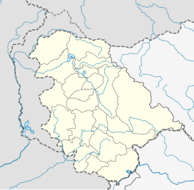
Jantroon Dhar or Jantroon Top is a location in the Doda district, in Jammu and Kashmir, India. It is a local hill station and a meadow in the Forest Block area, 15 kilometers away from Thathri. The place is surrounded by lush green meadows, snow in winters and covered with dense vegetation. Thousands of local tourists visit every year for spectating three days dangal-cum-wrestling match.[1]
Etymology
[edit]The word Jantroon is derived from Gojri phrase "Jannat Ma Roon" (trans: Living in Paradise) which later emerged as Jantroon.[2]
About and demographics
[edit]The hill station lies in the tehsil Chiralla and Jammu and Kashmir, earlier in Thathri tehsil of Jammu and Kashmir and does not inhabit (Un-inhabited) any population or households near it. [3] Local tourists visit annually in Summer to explore the place.
Development
[edit]As of 2019[update] Jantroon Dhar is 5 km away from the nearest road. Plans have been discussed by the district development commissioner to connect it to the road network.[4]
References
[edit]- ^ Sulaman wins Jantroon Top wrestling in Doda
- ^ Ayoob, Anzer (4 February 2021). "JANTROON: A SCENERY THAT SANS FOR GOVT'S EMPATHY". The Chenab Times. Retrieved 5 February 2021.
- ^ Jantroon - Forest Block Census
- ^ "DDC Doda discussed about Jantroon". Jammu Links News. 19 August 2016. Retrieved 13 July 2020.

