Jackton
| Jackton | |
|---|---|
 The main road through Jackton | |
| Population | 100 |
| OS grid reference | NS 592 529 |
| Lieutenancy area | |
| Country | Scotland |
| Sovereign state | United Kingdom |
| Post town | GLASGOW |
| Postcode district | G75 |
| Dialling code | 01355 |
| Police | Scotland |
| Fire | Scottish |
| Ambulance | Scottish |
| UK Parliament | |
| Scottish Parliament | |
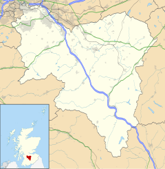
Jackton is a small village lying just on the western periphery of East Kilbride in South Lanarkshire, on the B764 road (otherwise known as the 'Eaglesham Road') connecting it to the village of Eaglesham. It is also adjacent to Thorntonhall, and the two villages share a newsletter, the Peel News, derived from the name of the road connecting the two. The settlement, as well as an area of surrounding farmland going as far as Lindsayfield was designated as a Community Growth Area for East Kilbride in South Lanarkshire's Local Development Plan 2.[1] The development of new build housing, additional retail locations, and a new primary school are planned and under construction as of March 2023. Jackton lies approximately 150 metres (490 ft) above sea level.
It is also the site of one of the two Scottish Training Centres for Police Scotland.[2] The area is served by Thorntonhall railway station, which is around 1+1⁄2 miles (2.4 km) away, and Hairmyres railway station, which is around 1.3 miles (2 km) away.
The Gill Burn runs through the outskirts of the settlement. There is only one bus stop on each side of the road for the village. The only buses running through are the 395/396 run by Henderson Travel.
The nearby fields to the immediate southeast of Jackton have received planning approval to be the site of a large Community Growth Area (housing estate) which will entirely engulf the small village. The development, creating a continuous built-up area over 1.5 square miles (3.9 km2) to connect with Lindsayfield, will include a primary school and a new link road. There will also be a large roundabout at the current hamlet.[3][4] In 2019 it was approved to build a further 70 homes in the area, consisting of 4 and 5 bedroomed properties.[5]
In 2019, one of the streets in the area was the scene of gunfire, which caused a large police presence while it was investigated.[6]
The area is represented by the local Jackton and Thorntonhall Community Council. The community lies on the very western edges of the South Lanarkshire Council boundary, and also the UK Parliament constituency of East Kilbride, Strathaven and Lesmahagow, as well as the Scottish Parliament Constituency of East Kilbride.
References
[edit]- ^ "Development plans".
- ^ "Facilities at Tulliallan and Jackton - Police Scotland". Police Scotland. Retrieved 17 February 2019.
- ^ East Kilbride Community Growth Area, South Lanarkshire Council / Scottish Government, September 2008
- ^ Multi-million pound investment in East Kilbride Community Growth Area given green light, Daily Record, 25 August 2018
- ^ Findlay, Nicola (8 February 2019). "South Lanarkshire Council green light 70 new Jackton homes as part of East Kilbride growth plan". Daily Record. Retrieved 22 October 2019.
- ^ "Police investigate 'targeted' East Kilbride gunshot incident". BBC News. 16 September 2019. Retrieved 11 May 2021.
External links
[edit]![]() Media related to Jackton at Wikimedia Commons
Media related to Jackton at Wikimedia Commons


