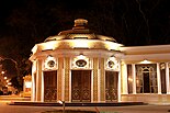
Istiglaliyyat Street
This article needs additional citations for verification. (May 2021) |
 | |
| Maintained by | City of Baku |
|---|---|
| Length | 2.2 km (1.4 mi)[1] |
| Location | Sabail raion |
| Coordinates | 40°22′06″N 49°49′56″E / 40.3682°N 49.8323°E |
| South end | Gulustan Palace |
| Northeast end | Aziz Aliyev Street |
Istiglaliyyat Street (Azerbaijani: İstiqlaliyyət küçəsi) is an arterial road in the central uptown part of Baku, Azerbaijan. It begins at Gulustan Palace, located on the southern hillside part of Baku, and continues north, then northeast, terminating at the intersection of Aziz Aliyev and Mammad Amin Rasulzade Streets at the edge of Fountains Square.
Overview of the street
[edit]Istiglaliyyat is one of the oldest streets of Baku. The former names of the street were "Nikolayevskaya", honoring the Russian tsar Nikolay I during Russian imperial rule, "Parlamentskaya" after the revolution, and "Kommunisticheskaya" during Soviet rule. After the restoration of Azerbaijan's independence in 1991, the street was renamed to "Istiglaliyyat", which means "Sovereignty" in Azerbaijani. It stretches for 2.2 kilometres (1.4 mi). Due to its location in the historic district, it is considered one of the most beautiful parts of Baku. There are many government offices, universities, shops, boutiques, and restaurants on the street.
Notable buildings and monuments located on Istiglaliyyat Street
[edit]- Gulustan Palace
- United Nations Representative Office in Azerbaijan
- Presidential Palace, office of the President of Azerbaijan
- Azerbaijan State Philharmonic Hall
- Western University
- Mayoralty of Baku
- Azerbaijan State Economic University
- Azerbaijan National Academy of Sciences
- Icheri Sheher Metro Station
- Ichari Shahar northern wall
- Mirza Alakbar Sabir garden
- Monument to Nizami Ganjavi
- Nizami Museum of Azerbaijan Literature
Picture gallery
[edit]- Nikolayevskaya
-
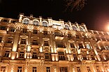
House of Mirzabekian brothers on Istiglaliyyat
-
Nikolayevskaya during the day
-
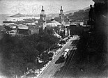
City Duma (Alexander Nevsky Cathedral in the background)
-
Camels on Nikolayevskaya
-
Nikolayevskaya before the revolution
-
Nikolayevskaya
-
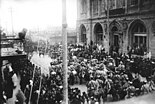
Azerbaijani Army parade on Istiglaliyyat Street on 29 October 1919
- Kommunisticheskaya
-
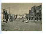
Kommunisticheskaya Street in 1930
-
Publishing house
-
Kommunisticheskaya
-
View of Philharmonic Hall
-
Close to the Governor's Park
- Istiglaliyyat Street
-
Institute of Manuscripts
-
Building of Azerbaijan National Academy of Sciences
-
Oncoming traffic at intersection with Husu Hajiyev Street
-
One of the Icheri Sheher gates
-
Former Ismailiya
-
House of Mirzabekian brothers
-
Philharmonic Hall at night
-
Northeastern end of Istiglaliyyat Street
References
[edit]- ^ Google Maps


