Isla Gonzalo
Appearance
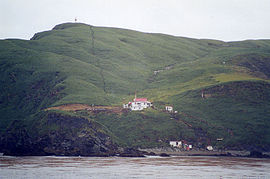
 The island with its weather station | |
| Geography | |
|---|---|
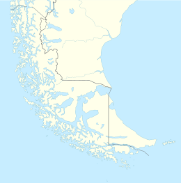
| Coordinates | 56°31′30″S 68°41′00″W / 56.52500°S 68.68333°W |
| Archipelago | Diego Ramírez Islands |
| Area | 0.38 km2 (0.15 sq mi) |
| Administration | |
| Region | Magallanes |
| Province | Antártica |
| Commune | Cabo de Hornos |
| Additional information | |
| NGA UFI=-883269 | |
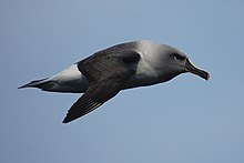
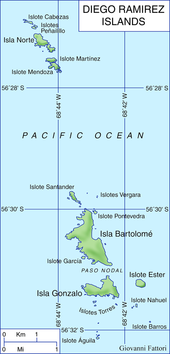
Isla Gonzalo is a subantarctic island, uninhabited except for a weather and research station operated by the Chilean Navy. With an area of 38 hectares (94 acres), it is the second largest of the Chilean Diego Ramírez Archipelago after Isla Bartolomé. The archipelago lies in the Drake Passage between the continents of South America and Antarctica. It is an important breeding site for black-browed (over 6000 pairs) and grey-headed (over 4000 pairs) albatrosses, as well as for southern giant petrels.[1][2]

See also
[edit]- List of islands of Chile
- List of Antarctic and sub-Antarctic islands
- List of fjords, channels, sounds and straits of Chile
References
[edit]- ^ "Island – Isla Bartolome". Island Group - Islas Diego Ramirez. Agreement on the Conservation of Albatrosses and Petrels. 2011. Retrieved 2011-07-21.
- ^ Robertson, Graham; Moreno, Carlos A.; Lawton, Kieran; Arata, Javier; Valencia, Jose; Kirkwood, Roger. (2007). "An estimate of the population sizes of Black-browed (Thalassarche melanophrys) and Grey-headed (T. chrysostoma) Albatrosses breeding in the Diego Ramírez Archipelago, Chile". Emu. 107 (3): 239–244. doi:10.1071/mu07028. S2CID 83796801. Archived from the original on 2012-03-28. Retrieved 2011-07-21.
External links
[edit]- Islands of Chile @ United Nations Environment Programme Archived 2013-05-01 at the Wayback Machine
- World island information @ WorldIslandInfo.com
- South America Island High Points above 1000 meters
- United States Hydrographic Office, South America Pilot (1916)
56°31′30″S 68°41′00″W / 56.52500°S 68.68333°W


