Irving Reef
Appearance
| Disputed atoll | |
|---|---|
 Irving Reef | |
| Other names | Balagtas Reef (Philippine English) Bahura ng Balagtas (Filipino) đá Đá Nhám (Vietnamese) 火艾礁 Huǒ'ài Jiāo (Chinese) |
| Geography | |
| Location | South China Sea |
| Coordinates | 10°52′N 114°55′E / 10.86°N 114.92°E |
| Archipelago | Spratly Islands |
| Administration | |
| Region | IV-B - MIMAROPA |
| Province | Palawan |
| Municipality | Kalayaan |
| Claimed by | |
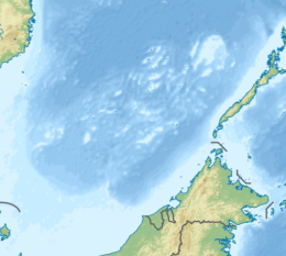
Irving Reef, also known as Balagtas Reef (Filipino: Bahura ng Balagtas; Mandarin Chinese: 火艾礁; pinyin: Huǒ'ài Jiāo, Vietnamese: đá Cá Nhám), is a coral atoll in the Spratly Islands, South China Sea. It is occupied by the Philippines as part of Kalayaan, Palawan,[1][2] and is also claimed by the People's Republic of China, the Republic of China (Taiwan) and Vietnam.
The atoll is 11 nautical miles (20 km; 13 mi) southwest of West York Island. It is 2 nautical miles (3.7 km; 2.3 mi) in length.[3] There is a sand cay near the northern extremity.[4]
References
[edit]- ^ "Smart maintains GSM service on Pag-asa Is". The Philippine Star. 2011-07-30. Retrieved 2012-08-14.
- ^ Esplanada, Jerry (2011-06-06). "Manila's claim in Spratlys within West Philippine Sea". Philippine Daily Inquirer. Retrieved 2012-08-14.
- ^ D. J. Hancox, John Robert Victor Prescott, A Geographical Description of the Spratly Islands and an Account of Hydrographic Surveys Amongst Those Islands (International Boundaries Research Unit, 1995, ISBN 978-1897643181, p. 7. Excerpts available at Google Books.
- ^ Sailing Directions 161 (Enroute) - South China Sea and the Gulf of Thailand (13 ed.). Bethesda, Maryland: National Geospatial-Intelligence Agency. 2011. p. 10.

