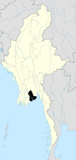
Insein Township
Insein Township
အင်းစိန်မြို့နယ် | |
|---|---|
| Coordinates: 16°53′34″N 96°5′53″E / 16.89278°N 96.09806°E | |
| Country | Myanmar |
| Division | Yangon |
| City | Yangon |
| Area | |
• Total | 35.0 km2 (13.52 sq mi) |
| Population (2019)[1] | |
• Total | 285,500 |
| • Density | 8,200/km2 (21,000/sq mi) |
| • Ethnic groups | |
| Time zone | UTC6:30 (MMT) |
| Postal codes | 11011, 11012, 11013 |
| Area code(s) | 1 (mobile: 80, 99) |
| YCDC[2] | |
Insein Township (Burmese: အင်းစိန်မြို့နယ်, pronounced [ɪ́ɰ̃sèiɰ̃ mjo̰nɛ̀]) is located in northern Yangon. The township comprises 21 wards, and shares borders with Shwepyitha township in the north, Hlaingthaya township in the west, Mingaladon township in the east and Mayangon township in the south.[2] Insein is home to the Insein Prison, the most notorious prison in the country that houses hundreds of political prisoners. Until the 1990s, Insein, about 20 miles (32 km) from central Yangon, was beyond Yangon's city limits although by the 1980s, Insein was already integrated with the rest of the city. With the expansion of Yangon's city limits in the 1990s which also included founding new satellite towns, Insein was formally incorporated into Yangon.
Etymology
[edit]The word "Insein" means "precious lake" in the Burmese language, and is also a former name of Inya lake.[3] However, the etymology of "Insein" is derived from the Mon language term Mon: အၚ်စိၚ် (/ɛŋ coiŋ/), meaning "elephant lake."[4][5]
History
[edit]Insein was a famous battle site in the Burmese civil war that erupted after the country's independence from the United Kingdom in January 1948. Insein was the limit Karen insurgents reached in January 1949 in their ambitious attempt to take Yangon and oust the Burmese government.[6]
Education
[edit]Insein has 33 primary schools, ten middle schools and six high schools.[2] Karen Baptist Theological Seminary, the Myanmar Institute of Theology, the University of Paramedical Science, Yangon, Yangon Technological University and are located in the township.
Health
[edit]The Insein General Hospital is the principal hospital. Thiri Sandar Hospital Kwekabaw Hospital Kaung Hospital and KBC Hospital are private hospitals
Sport
[edit]There is YCDC Golf Club Swimming Pool & Restaurant[7] located at Thiri Mingalar street.
Landmarks
[edit]The following is a list of landmarks protected by the city in Insein township.[8]
| Structure | Type | Address | Notes |
|---|---|---|---|
| Animal Husbandry and Veterinary Science Institute Headquarters | Office | ||
| BEHS 1 Insein | School | Baho Road Part 4 (Mingyi Road) | |
| Criminal Investigation Department (CID) | Office | Lower Mingaladon Road | |
| Government Technical Institute, Insein | College | Lower Mingaladon Road | |
| Insein General Hospital | Hospital | Baho Road Part 4 (Mingyi Road) | |
| Myanmar Institute of Theology | College | Yangon-Insein Road | |
| Su Paung Yon Office Complex | Office | Baho Road Part 4 (Mingyi Road) | |
| Little yangon | Preschool | Nikbanda street |
References
[edit]- ^ "General Administration Department's 2019 census of Insein" (PDF).
- ^ a b c "Insein Township". Yangon City Development Committee. Archived from the original on 2 October 2011. Retrieved 2009-03-15.
- ^ journal of the Burma Research Society. Vol. 39–41. 1955. p. 188.
- ^ Tun, Than (1988). "Observations on the Translation and Annotation of the Royal Orders Of Burma". Crossroads: An Interdisciplinary Journal of Southeast Asian Studies. 4 (1): 91–99. JSTOR 40860260.
- ^ Banyar, Ko (7 November 2013). "မွန်တို့ဌာနေ ရာမည တိုင်းက မွန် အခေါ်အဝေါ်များ". Phophtaw News Association. Archived from the original on 26 June 2015.
- ^ Aung Zaw (2009-02-09). "The Battle of Insein Never Really Ended". The Irrawaddy. Archived from the original on 14 February 2009. Retrieved 15 March 2009.
- ^ "Activities-Directory".
- ^ "Special Reports: Heritage List". The Myanmar Times. 2001-10-29. Archived from the original on 15 June 2009.


