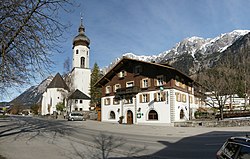
Innerbraz
Appearance
You can help expand this article with text translated from the corresponding article in German. (April 2010) Click [show] for important translation instructions.
|
Innerbraz | |
|---|---|
 | |
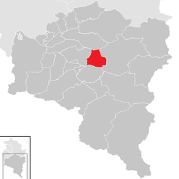
 Location in the district | |
| Coordinates: 47°08′00″N 09°55′00″E / 47.13333°N 9.91667°E | |
| Country | Austria |
| State | Vorarlberg |
| District | Bludenz |
| Government | |
| • Mayor | Hans Peter Pfanner |
| Area | |
• Total | 19.97 km2 (7.71 sq mi) |
| Elevation | 708 m (2,323 ft) |
| Population (2018-01-01)[2] | |
• Total | 994 |
| • Density | 50/km2 (130/sq mi) |
| Time zone | UTC+1 (CET) |
| • Summer (DST) | UTC+2 (CEST) |
| Postal code | 6751 |
| Area code | 05552 |
| Vehicle registration | BZ |
| Website | www.innerbraz.at |
Innerbraz is a municipality in the district of Bludenz in the Austrian state of Vorarlberg.
Population
[edit]| Year | Pop. | ±% |
|---|---|---|
| 1869 | 438 | — |
| 1880 | 383 | −12.6% |
| 1890 | 443 | +15.7% |
| 1900 | 464 | +4.7% |
| 1910 | 508 | +9.5% |
| 1923 | 501 | −1.4% |
| 1934 | 465 | −7.2% |
| 1939 | 478 | +2.8% |
| 1951 | 722 | +51.0% |
| 1961 | 726 | +0.6% |
| 1971 | 810 | +11.6% |
| 1981 | 844 | +4.2% |
| 1991 | 930 | +10.2% |
| 2001 | 975 | +4.8% |
| 2011 | 950 | −2.6% |
Transport
[edit]The municipality is located along an expressway, the Arlberg Schnellstraße (S16), between Bludenz and Zams (Tyrol).
Braz and Hintergasse are two defunct railway stations on the Arlberg Railway line (Bludenz–Innsbruck Hauptbahnhof).
References
[edit]- ^ "Dauersiedlungsraum der Gemeinden Politischen Bezirke und Bundesländer - Gebietsstand 1.1.2018". Statistics Austria. Retrieved 10 March 2019.
- ^ "Einwohnerzahl 1.1.2018 nach Gemeinden mit Status, Gebietsstand 1.1.2018". Statistics Austria. Retrieved 9 March 2019.
Wikimedia Commons has media related to Innerbraz.


