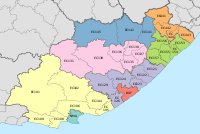
Ingquza Hill Local Municipality
Ingquza Hill | |
|---|---|
 Location in the Eastern Cape | |
| Coordinates: 32°10′S 28°35′E / 32.167°S 28.583°E | |
| Country | South Africa |
| Province | Eastern Cape |
| District | OR Tambo |
| Seat | Flagstaff |
| Wards | 31 |
| Government | |
| • Type | Municipal council |
| • Mayor | BB Goya (ANC) |
| • Speaker | Ntandokazi Yolisa Chapa (ANC) |
| • Chief Whip | Mbongeni Isaac Nkungu (ANC) |
| Area | |
| • Total | 2,477 km2 (956 sq mi) |
| Population (2011)[2] | |
| • Total | 278,481 |
| • Density | 110/km2 (290/sq mi) |
| Racial makeup (2011) | |
| • Black African | 99.2% |
| • Coloured | 0.4% |
| • Indian/Asian | 0.1% |
| • White | 0.1% |
| First languages (2011) | |
| • Xhosa | 94.6% |
| • English | 2.2% |
| • Other | 3.2% |
| Time zone | UTC+2 (SAST) |
| Municipal code | EC153 |

Ingquza Hill Municipality (Xhosa: uMasipala wase Ingquza Hill), previously known as Qaukeni Municipality, is a local municipality within the OR Tambo District Municipality, in the Eastern Cape province of South Africa.
Main places
[edit]The 2001 census divided the municipality into the following main places:[4]
| Place | Code | Area (km2) | Population |
|---|---|---|---|
| Amakwalo | 23201 | 123.86 | 8,467 |
| Amanci | 23202 | 5.21 | 706 |
| Amantlane | 23203 | 117.16 | 12,588 |
| Awahlwazi | 23204 | 25.03 | 4,082 |
| Bala | 23205 | 134.39 | 15,995 |
| Emtweni | 23206 | 53.32 | 2,023 |
| Flagstaff | 23207 | 13.77 | 3,069 |
| Gunyeni | 23208 | 45.12 | 13,493 |
| Lusikisiki | 23209 | 21.04 | 9,079 |
| Lwandlolubomvu | 23210 | 1.24 | 78 |
| Mkambati | 23211 | 173.29 | 800 |
| Mtshayelo | 23212 | 14.63 | 1,980 |
| Mxobo | 23213 | 86.08 | 9,632 |
| Ndimakude | 23214 | 16.10 | 1,765 |
| Sipaqeni | 23216 | 249.31 | 34,069 |
| Taweni | 23217 | 342.85 | 35,362 |
| Xopozo | 23218 | 79.49 | 7,835 |
| Remainder of the municipality | 23215 | 958.25 | 94,357 |
Politics
[edit]The municipal council consists of sixty-four members elected by mixed-member proportional representation. Thirty-two councillors are elected by first-past-the-post voting in thirty-two wards, while the remaining thirty-two are chosen from party lists so that the total number of party representatives is proportional to the number of votes received. In the election of 1 November 2021 the African National Congress (ANC) won a majority of forty-six seats on the council. The following table shows the results of the election.[5]
| Party | Ward | List | Total seats | |||||
|---|---|---|---|---|---|---|---|---|
| Votes | % | Seats | Votes | % | Seats | |||
| African National Congress | 41,478 | 67.23 | 28 | 44,529 | 75.84 | 18 | 46 | |
| Economic Freedom Fighters | 5,156 | 8.36 | 0 | 5,530 | 9.42 | 6 | 6 | |
| Independent candidates | 7,658 | 12.41 | 4 | 4 | ||||
| Civic Independent | 1,771 | 2.87 | 0 | 2,068 | 3.52 | 2 | 2 | |
| Democratic Alliance | 1,814 | 2.94 | 0 | 1,513 | 2.58 | 2 | 2 | |
| African Transformation Movement | 1,211 | 1.96 | 0 | 1,369 | 2.33 | 1 | 1 | |
| United Democratic Movement | 1,062 | 1.72 | 0 | 1,184 | 2.02 | 1 | 1 | |
| African Independent Congress | 382 | 0.62 | 0 | 972 | 1.66 | 1 | 1 | |
| African People's Convention | 486 | 0.79 | 0 | 411 | 0.70 | 1 | 1 | |
| Congress of the People | 292 | 0.47 | 0 | 392 | 0.67 | 0 | 0 | |
| Pan Africanist Congress of Azania | 184 | 0.30 | 0 | 244 | 0.42 | 0 | 0 | |
| African Christian Democratic Party | 193 | 0.31 | 0 | 185 | 0.32 | 0 | 0 | |
| Inkatha Freedom Party | 6 | 0.01 | 0 | 321 | 0.55 | 0 | 0 | |
| Total | 61,693 | 100.00 | 32 | 58,718 | 100.00 | 32 | 64 | |
| Valid votes | 61,693 | 97.50 | 58,718 | 94.55 | ||||
| Invalid/blank votes | 1,581 | 2.50 | 3,383 | 5.45 | ||||
| Total votes | 63,274 | 100.00 | 62,101 | 100.00 | ||||
| Registered voters/turnout | 139,517 | 45.35 | 139,517 | 44.51 | ||||
References
[edit]- ^ "Contact list: Executive Mayors". Government Communication & Information System. Archived from the original on 14 July 2010. Retrieved 22 February 2012.
- ^ a b "Statistics by place". Statistics South Africa. Retrieved 27 September 2015.
- ^ "Statistics by place". Statistics South Africa. Retrieved 27 September 2015.
- ^ Lookup Tables - Statistics South Africa[permanent dead link]
- ^ "Election Result Table for LGE2021 — Ingquza Hill". wikitable.frith.dev. Retrieved 26 December 2021.


