Ingelum
Engelum
Ingelum | |
|---|---|
Village | |
 Church of Engelum | |
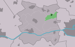
 Location in Menameradiel municipality | |
| Coordinates: 53°13′32″N 5°42′55″E / 53.22556°N 5.71528°E | |
| Country | Netherlands |
| Province | Friesland |
| Municipality | Waadhoeke |
| Area | |
• Total | 2.19 km2 (0.85 sq mi) |
| Elevation | 1.3 m (4.3 ft) |
| Population (2021)[1] | |
• Total | 375 |
| • Density | 170/km2 (440/sq mi) |
| Postal code | 9038[1] |
| Dialing code | 058 |
Ingelum (Dutch: Engelum) is a village in Waadhoeke in the province of Friesland, the Netherlands. It had a population of around 386 in January 2017.[3] Before 2018, the village was part of the Menameradiel municipality.[4]
History
[edit]The village was first mentioned in 1319 as Enghelum, and can either mean "settlement of Engel (person)" or "settlement of the Angles (as in England)".[5] Ingelum is a terp (artificial living hill) village from the beginning of our era. It was located near the Middelzee.[6]
The stins Grovestins was located on the dike near Ingelum, and was built before 1446. In 1446, the estate was taken by the Schieringers. Frederik Sirtema van Grovestins fought against France in 1712. During his expedition, he destroyed 35 villages and 18 castles around Metz. The estate was demolished in 1757.[7]
The Dutch Reformed church was built in 1773 as a replacement of its medieval predecessor.[8] The church was destroyed in a fire in 1975, and rebuilt in 1980. The tower was restored in 2009.[4][6]
Ingelum was home to 247 people in 1840.[4] Since 1995, Ingelum is the start and finish of the annual Eleven City Tractor Race. The race with old-timer tractors was first conceived in 1990, but ran into objections from the police who would not allow tractors racing on public streets.[4]
References
[edit]- ^ a b c "Kerncijfers wijken en buurten 2021". Central Bureau of Statistics. Retrieved 4 April 2022.
- ^ "Postcodetool for 9038TA". Actueel Hoogtebestand Nederland (in Dutch). Het Waterschapshuis. Retrieved 4 April 2022.
- ^ Feiten en cijfers - Menameradiel
- ^ a b c d "Ingelum". Plaatsengids (in Dutch). Retrieved 4 April 2022.
- ^ "Engelum - (geografische naam)". Etymologiebank (in Dutch). Retrieved 4 April 2022.
- ^ a b "Ingelum". Friesland Wonderland (in Dutch). Retrieved 4 April 2022.
- ^ "Grovestins te Engelum". Stinsen in Friesland (in Dutch). Retrieved 4 April 2022.
- ^ "Monumentnummer: 28613 Tsjerkeleane 4 9038 TD te Ingelum". Dutch Monument Register (in Dutch). Retrieved 4 April 2022.


