Independência, Ceará
Appearance
Independência | |
|---|---|
Municipality | |
| The Municipality of Independência | |
| Nickname: "Porronca" | |
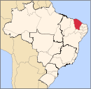
 Location of Independência in the State of Ceará | |
| Coordinates: 05°23′45″S 40°18′32″W / 5.39583°S 40.30889°W | |
| Country | |
| Region | Northeast |
| State | |
| Founded | July 24, 1857 |
| Government | |
| • Mayor | José Valdi Coutinho (PMDB) |
| Area | |
| • Total | 3,218.641 km2 (1,242.724 sq mi) |
| Elevation | 105 m (343 ft) |
| Population (2020 [1]) | |
| • Total | 26,187 |
| • Density | 8.1/km2 (21/sq mi) |
| Time zone | UTC-3 (UTC-3) |
| HDI (2000) | 0.657 – medium[2] |
| Website | www.independencia.ce.gov.br/ |
Independência is a municipality of the Northeastern state of Ceará in Brazil. It is the fourth largest by area in that state.
References
[edit]


