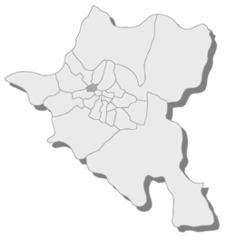
Ilinden, Sofia
Appearance
Ilinden
Илинден | |
|---|---|
 Position of Ilinden in Sofia | |
| Coordinates: 42°42′46″N 23°17′24″E / 42.71278°N 23.29000°E | |
| Country | Bulgaria |
| City | Sofia |
| Government | |
| • Mayor | Ivan Bozhilov |
| Area | |
| • Total | 3.31 km2 (1.28 sq mi) |
| Population (17.08.2017) | |
| • Total | |
| Time zone | UTC+2 (EET) |
| • Summer (DST) | UTC+3 (EEST) |
| Website | Official Site of Ilinden District |
Ilinden (Bulgarian: Илинден [iˈlindɛn]) is a district[1] of Sofia, located in the western parts of the city. As of 2006[update] it has 37,256 inhabitants. There are four neighbourhoods: "Zaharna Fabrika", "Gevgeliiski", "Sveta Troitsa" (Holy Trinity) and "Ilinden".
References
[edit]- ^ "District Mayors". Sofia Municipality. Archived from the original on 2009-12-20. Retrieved 2009-12-26.
