Ikast-Brande Municipality
Appearance
Ikast-Brande Municipality
Ikast-Brande Kommune (Danish) | |
|---|---|
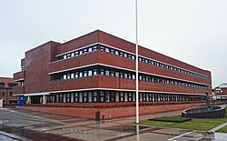
 Town hall | |
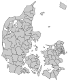
 Location in Denmark | |
| Coordinates: 56°08′27″N 9°09′06″E / 56.1408°N 9.1517°E | |
| Country | Denmark |
| Region | Central Denmark |
| Established | 1 January 2007 |
| Government | |
| • Mayor | Ib Boye Lauritsen |
| Area | |
| • Total | 736.41 km2 (284.33 sq mi) |
| Population (1. January 2024)[1] | |
| • Total | 42,737 |
| • Density | 58/km2 (150/sq mi) |
| Time zone | UTC+1 (CET) |
| • Summer (DST) | UTC+2 (CEST) |
| Website | www |
Ikast-Brande Municipality (Danish: Ikast-Brande Kommune) is a municipality (Danish: kommune) in Region Midtjylland in Denmark. It covers an area of 733.69 km2 and has a population of 42,737 (1. January 2024).
On 1 January 2007 Ikast-Brande municipality was created as the result of Kommunalreformen ("The Municipal Reform" of 2007), consisting of the former municipalities of Brande, Ikast, and Nørre-Snede.
Locations
[edit]| Ikast | 16,000 |
| Brande | 7,400 |
| Bording | 2,400 |
| Engesvang | 2,000 |
| Nørre Snede | 1,800 |
| Ejstrupholm | 1,600 |
Politics
[edit]Municipal council
[edit]Ikast-Brande's municipal council consists of 23 members, elected every four years.
Below are the municipal councils elected since the Municipal Reform of 2007.
| Election | Party | Total seats |
Turnout | Elected mayor | ||||||||||
|---|---|---|---|---|---|---|---|---|---|---|---|---|---|---|
| A | C | D | F | K | L | O | V | |||||||
| 2005 | 6 | 2 | 1 | 8 | 2 | 8 | 27 | 73.9% | Carsten Kissmeyer (V) | |||||
| 2009 | 5 | 2 | 1 | 8 | 2 | 7 | 25 | 71.4% | ||||||
| 2013 | 6 | 1 | 5 | 2 | 9 | 23 | 75.3% | |||||||
| 2017 | 6 | 3 | 2 | 3 | 9 | 72.5% | Ib Lauritsen (V) | |||||||
| 2021 | 6 | 5 | 1 | 2 | 2 | 7 | 66.7% | |||||||
| Data from Kmdvalg.dk 2005, 2009, 2013, 2017 and 2021 | ||||||||||||||
References
[edit]- ^ BY2: Population 1. January by municipalities The Mobile Statbank from Statistics Denmark
- Municipal statistics: NetBorger Kommunefakta, delivered from KMD a.k.a. Kommunedata (Municipal Data)
- Municipal mergers and neighbors: Eniro new municipalities map
External links
[edit]Wikimedia Commons has media related to Ikast-Brande Kommune.
- Ikast-Brande municipality's official website (in Danish)


