Iōtorishima

Iōtorishima (硫黄鳥島, Literal: "sulfur bird island") or Iwo Tori-shima, also called Okinawa Torishima (沖縄鳥島), is a volcanic island part of the Ryūkyū Island chain with the only[1] active volcano in Okinawa Prefecture.
Geography
[edit]
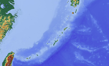
Iotourishima is located 65 km west of Tokunoshima Island. On exceptionally clear days, Iōtorishima can be seen from the west coast of Tokunoshima.
The 2.50 km2[2] large island consists of two interconnected volcanoes made from andesite. The southern Gusuku kazan (グスク火山, "Castle Volcano") is a lava dome located in the center of the two summits. The northern Iōdake-kazan (硫黄岳火山, "Sulfur Peak Volcano") is a stratovolcano whose crater consists of a small lake of sulfur. It is still active, although none of the recent outbreaks had explosive character.[3][4] The highest point of the island is at 212 m, which belongs to Iōdake-kazan; the highest of the Gusuku kazan is the Maedake (前嶽) at 189.3 m.[5]
History
[edit]Sulfur was mined by the inhabitants for centuries[1] within the Kingdom of Ryukyu, and it was used as tribute to the Chinese Empire.[6]
The first recorded eruption was in 1664, when a woman died from a landslide.[7] In a series of eruptions and earthquakes from March to August 1903, all residents were temporarily moved 220 km to Kume Island, but were permanently relocated by June 1958; the final settlement had 86 inhabitants. Since then, the island has been uninhabited. In July 1968 there was another eruption.
Administratively, the island belonged to Gushikawa on Kume-jima, but merged in 2002 with Nakazato to the city Kumejima.
See also
[edit]External links
[edit]Commons: Io-Torishima - Collection of pictures, videos and audio files relating to the island.
References
[edit]- ^ a b "Creating a cadastral map of Iwo-Tori-shima". Ryukyu Shimpo - Okinawa, Japanese newspaper, local news. Retrieved 2019-02-07.
- ^ "島しょ別面積/沖縄県". www.pref.okinawa.jp. Archived from the original on 2020-04-17. Retrieved 2019-02-07.
- ^ "Io-Torishima". Global Volcanism Program. Smithsonian Institution. Retrieved 2021-06-24.
- ^ "硫黄鳥島|海域火山データベース|海上保安庁 海洋情報部". www1.kaiho.mlit.go.jp. Retrieved 2019-02-07.
- ^ "地理院地図". maps.gsi.go.jp. Retrieved 2019-02-07.
- ^ "Relocation of Tori Shima Range to Iwo-Tori-shima". Ryukyu Shimpo - Okinawa, Japanese newspaper, local news. Retrieved 2019-02-07.
- ^ Information (NCEI), National Centers for Environmental. "Resource Removed | NCEI". www.ngdc.noaa.gov. Retrieved 2019-02-07.

