Honnihalli
This article needs additional citations for verification. Please help improve this article by adding citations to reliable sources. Unsourced material may be challenged and removed. Find sources: "Honnihalli" – news · newspapers · books · scholar · JSTOR (December 2020) (Learn how and when to remove this message) |
Honnihalli | |
|---|---|
Village | |
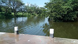
 Honnihalli Water Barrier | |
 | |
| Country | |
| State | Karnataka |
| District | Belagavi |
| Talukas | Hukeri |
| Languages | |
| • Official | Kannada |
| Time zone | UTC+5:30 (IST) |
| PIN | 591225 |
| Telephone code | +91 8333 |
| Nearest city | Sankeshwar |
Honnihalli is a village in Belagavi district in the southern state of Karnataka, India.[1]
According to Census 2011 information the location code or village code of Honnihalli village is 591225. Honnihalli village is located in Hukkeri Tehsil of Belagavi district in Karnataka, India. It is situated 24km away from sub-district headquarter Hukkeri and 60km away from district headquarter Belagavi. Kannada is the common language of Honnihalli.
Population
[edit]Honnihalli has a total population of 1,695 people with 843 male and 852 female population respectively. There are about 355 houses in Honnihalli village. Sankeshwar is nearest town to Honnihalli which is approximately 07km away.
The total geographical area of the village is 395.86 hectares.
Distance
[edit]
50 km from Belgaum
45 km from Kolhapur
130 km from Goa Velha
290 km from Pune
Places to visit
[edit]Amboli is the nearest Hill station from Honnihalli, 70 km away. Ramlinga Teerthkshetra is a famous historical Place, 10 km away.
Hidkal dam is also known as Raja Lakhamgouda dam. This dam is constructed across the Ghataprabha River, with the Basin of the Krishna River. The dam is about 40 km from Honnihalli and is in close proximity to the Pune-Bangalore national highway No 4.
Gokak falls is located in Gokak town, 6 km away from the town centre and 45 km away from Honnihalli.
References
[edit]- ^ Village Directory, 2001 Census of India
15°14′N 75°00′E / 15.233°N 75.000°E / 15.233; 75.000
This article related to a location in Hukeri taluk, Belgaum district, Karnataka, India is a stub. You can help Wikipedia by expanding it. |
- Pages using gadget WikiMiniAtlas
- Articles needing additional references from December 2020
- All articles needing additional references
- Articles with short description
- Short description is different from Wikidata
- Use dmy dates from July 2018
- Use Indian English from July 2018
- All Wikipedia articles written in Indian English
- Short description matches Wikidata
- Infobox mapframe without OSM relation ID on Wikidata
- Pages using infobox settlement with no map
- Pages using infobox settlement with no coordinates
- Coordinates on Wikidata
- All stub articles
- Pages using the Kartographer extension
