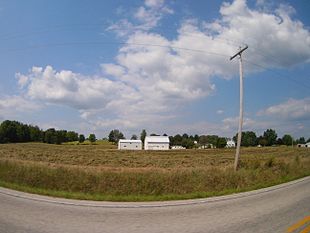
Highland Township, Greene County, Indiana
Appearance
Highland Township | |
|---|---|
 Countryside in Highland Township | |
 Location in Greene County | |
| Coordinates: 39°07′17″N 86°53′13″W / 39.12139°N 86.88694°W | |
| Country | United States |
| State | Indiana |
| County | Greene |
| Government | |
| • Type | Indiana township |
| Area | |
• Total | 32.69 sq mi (84.7 km2) |
| • Land | 32.47 sq mi (84.1 km2) |
| • Water | 0.22 sq mi (0.6 km2) 0.67% |
| Elevation | 545 ft (166 m) |
| Population (2020) | |
• Total | 688 |
| • Density | 21/sq mi (8.1/km2) |
| GNIS feature ID | 0453411 |
Highland Township is one of fifteen townships in Greene County, Indiana, USA. As of the 2020 census, its population was 688,[1] down from 718 at 2010.[2]
| Census | Pop. | Note | %± |
|---|---|---|---|
| 1890 | 1,143 | — | |
| 1900 | 980 | −14.3% | |
| 1910 | 977 | −0.3% | |
| 1920 | 897 | −8.2% | |
| 1930 | 742 | −17.3% | |
| 1940 | 753 | 1.5% | |
| 1950 | 595 | −21.0% | |
| 1960 | 494 | −17.0% | |
| 1970 | 513 | 3.8% | |
| 1980 | 581 | 13.3% | |
| 1990 | 583 | 0.3% | |
| 2000 | 655 | 12.3% | |
| 2010 | 718 | 9.6% | |
| 2020 | 688 | −4.2% | |
| Source: US Decennial Census[3] | |||
Geography
[edit]According to the 2010 census, the township has a total area of 32.69 square miles (84.7 km2), of which 32.47 square miles (84.1 km2) (or 99.33%) is land and 0.22 square miles (0.57 km2) (or 0.67%) is water.[2] The streams of Camp Creek, Clark Creek, Dead Horse Branch, Goose Creek, Jim Creek and Kelly Branch run through this township.
Unincorporated towns
[edit](This list is based on USGS data and may include former settlements.)
Adjacent townships
[edit]- Franklin Township, Owen County (north)
- Beech Creek Township (east)
- Richland Township (south)
- Fairplay Township (southwest)
- Jefferson Township (west)
Cemeteries
[edit]The township contains nine cemeteries: Bucher, Calvertville, Goodwin, Kelley, Owens, Snyder, Stalcup, Wall and Walnut Grove.
Major highways
[edit]Education
[edit]It is in the Bloomfield School District.[4]
References
[edit]- "Highland Township, Greene County, Indiana". Geographic Names Information System. United States Geological Survey, United States Department of the Interior. Retrieved September 24, 2009.
- United States Census Bureau cartographic boundary files
- ^ "Census Bureau profile: Highland Township, Greene County, Indiana". United States Census Bureau. May 2023. Retrieved April 7, 2024.
- ^ a b "Population, Housing Units, Area, and Density: 2010 - County -- County Subdivision and Place -- 2010 Census Summary File 1". United States Census. Archived from the original on February 10, 2020. Retrieved May 10, 2013.
- ^ "Township Census Counts: STATS Indiana".
- ^ "2020 CENSUS - SCHOOL DISTRICT REFERENCE MAP: Greene County, IN" (PDF). U.S. Census Bureau. Retrieved June 12, 2024. - Text list
External links
[edit]

