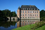
Hauteroche Castle
Appearance
| Hauteroche Castle | |
|---|---|
| Wallonia, Belgium | |
 Castle ruins | |
| Coordinates | 50°05′15″N 4°35′58″E / 50.0875°N 4.5994°E |
| Type | Castle |
| Site information | |
| Condition | Ruined |
Hauteroche Castle (French: Château de Hauteroche) is a ruined 14th-century castle, destroyed after a siege in 1554, in the village of Dourbes in the municipality of Viroinval, province of Namur, Wallonia, Belgium.
The castle site was scientifically excavated between 1976 and 2002.
See also
[edit]Sources
[edit]External links
[edit]References
[edit]- De Boe G., 1982. Le sanctuaire gallo-romain dans la plaine de Bieure à Matagne-la-Grande. Archaeologia Belgica, Brussels: Service National des Fouilles, p 25
- Plumier J. and Pleuger J.L., 1986: Le château de Hauteroche à Dourbes. Archaeologia Belgica II, Brussels: Service National des Fouilles, 1, p.109-112
- Pleuger J.L. and Pleuger E., 2001. Viroinval/Dourbes : fouille du château de Hauteroche. Chronique de l’Archéologie Wallonne, Namur, 9, p 227-228
- Pleuger J.L. and Pleuger E., 2002: Viroinval/Dourbes : fouille du château de Hauteroche. Chronique de l’Archéologie Wallonne, Namur, 9, p 255-256


