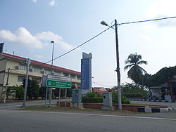
Hang Tuah Jaya
Hang Tuah Jaya | |
|---|---|
 | |
| Etymology: Hang Tuah | |
| Nickname(s): Smart City (Bandaraya Pintar) | |
| Coordinates: 2°16′N 102°17′E / 2.267°N 102.283°E | |
| Country | Malaysia |
| State | Malacca |
| District | Alor Gajah, Melaka Tengah and Jasin |
| Founded | 25 June 2006 |
| Municipality status | 1 January 2010 |
| Government | |
| • Type | Local government |
| • Body | Hang Tuah Jaya Municipal Council |
| • President | Sapiah Haron |
| Area | |
| • Total | 144.61 km2 (55.83 sq mi) |
| Postal code | 75xxx to 77xxx |
| Website | www |


Hang Tuah Jaya is a planned area in the Malaysian state of Malacca created by its government as the state's administrative centre and smart city with economical, social, infrastructural and recreational developments. It is the only landlocked municipality in the state.[1][2]
Etymology
[edit]Hang Tuah Jaya is named after the legendary Malay warrior – Hang Tuah and its name is a combination of the warrior's name with "jaya", a Sanskrit word adopted into Malay language which means "success" or "victory".
History
[edit]Before 2010, Hang Tuah Jaya was administered by the Hang Tuah Jaya Corporation (Malay: Perbadanan Hang Tuah Jaya, PHTJ), a state government agency which was established on 1 June 2005 and headquartered at Melaka International Trade Centre (MITC) to oversee its development.[3]
It was launched by the fifth Prime Minister of Malaysia, Abdullah Ahmad Badawi on 25 June 2006,[4] consists of parts of Melaka Tengah, Alor Gajah and Jasin districts and covers an area of 144 square kilometres (36,000 acres).[5] The area became a municipality on 1 January 2010 and governed by the Hang Tuah Jaya Municipal Council (Malay: Majlis Perbandaran Hang Tuah Jaya, MPHTJ), which is headquartered at Melaka Mall in Ayer Keroh, opposite the headquarters of the Malacca City Council along Ayer Keroh Highway.[6]
After Hang Tuah Jaya Municipal Council became the local government of Hang Tuah Jaya, Hang Tuah Jaya Corporation was rebranded as the Malacca Green Technology Corporation (Malay: Perbadanan Teknologi Hijau Melaka, MGTC or PTHM) on 8 November 2013.[7][8]
Administrative area
[edit]The administrative area consists of parts of the following mukims:[9][10]
- Melaka Tengah District (57.65863 square kilometres (14,247.76 acres))
- Ayer Molek
- Bachang
- Batu Berendam
- Bukit Baru
- Bukit Katil
- Peringgit
- Jasin District (52.04172 square kilometres (12,859.79 acres))
- Ayer Panas
- Kesang
- Alor Gajah District (34.90612 square kilometres (8,625.49 acres))
Mukim can be either a subdivision of a district or a subdivision of sub-district (Section 11(c) of the National Land Code 1965).
See also
[edit]References
[edit]- ^ "Puan Linda Phua Sue Lin". Archived from the original on 14 April 2011.
- ^ "Y.A.B Datuk Seri Mohd Ali". Archived from the original on 14 April 2011.
- ^ "Latar Belakang Perbadanan Hang Tuah Jaya". Archived from the original on 14 April 2011.
- ^ "Malacca ushers in 2010 with new Hang Tuah Jaya municipality". The Star (Malaysia). 2 January 2010.
- ^ "Background".
- ^ "YDP's message".
- ^ "Sustainable Energy Development Authority". seda.gov.my.
- ^ "Latar belakang - Teknologi Hijau Melaka". melakagreentech.gov.my.
- ^ "Publications".
- ^ "Laporan Tahunan 2018" (PDF).
External links
[edit]- Hang Tuah Jaya Municipal Council Archived 27 October 2021 at the Wayback Machine


