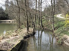
Hahnbach (Klingenbach)
Appearance
You can help expand this article with text translated from the corresponding article in German. (May 2018) Click [show] for important translation instructions.
|
| Hahnbach | |
|---|---|
 | |
| Location | |
| Country | Germany |
| State | Baden-Württemberg |
| Physical characteristics | |
| Mouth | Klingenbach |
• coordinates | 48°59′16″N 9°54′45″E / 48.9878°N 9.9126°E |
| Basin features | |
| Progression | Klingenbach→ Bühler→ Kocher→ Neckar→ Rhine→ North Sea |
| Tributaries | |
| • right | Rotklingenbach |

The Hahnbach (also: Hambach) is a river of Baden-Württemberg, Germany. It is a right tributary of the Klingenbach near Bühlerzell.[1]
See also
[edit]References
[edit]- ^ "Hahnbach" (Map). Google Maps. Retrieved 1 May 2018.
