Habartov
Habartov | |
|---|---|
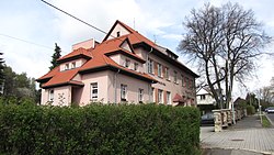
 Museum and library | |
| Coordinates: 50°10′59″N 12°33′07″E / 50.18306°N 12.55194°E | |
| Country | |
| Region | Karlovy Vary |
| District | Sokolov |
| First mentioned | 1339 |
| Government | |
| • Mayor | Petr Janura |
| Area | |
| • Total | 21.39 km2 (8.26 sq mi) |
| Elevation | 484 m (1,588 ft) |
| Population (2024-01-01)[1] | |
| • Total | 4,717 |
| • Density | 220/km2 (570/sq mi) |
| Time zone | UTC+1 (CET) |
| • Summer (DST) | UTC+2 (CEST) |
| Postal code | 357 09 |
| Website | www |
Habartov (German: Habersbirk) is a town in Sokolov District in the Karlovy Vary Region of the Czech Republic. It has about 4,700 inhabitants.
Administrative parts
[edit]The villages of Horní Částkov, Kluč, Lítov and Úžlabí are administrative parts of Habartov.
Geography
[edit]Habartov is situated about 7 kilometres (4 mi) west of Sokolov and 22 km (14 mi) west of Karlovy Vary. The northern part of the municipal territory with the town proper lies in the southwestern tip of the Ore Mountains, the southern part of Habartov extends into the Sokolov Basin. The highest point is the hill Částkovský vrch at 598 metres (1,962 ft) above sea level. Half of Medard Lake is situated in Habartov.
History
[edit]The first written mention of Habartov is from 1339. The most notable owners of the town were the Nostitz family, who held it from 1668 to 1719. Habartov grew thanks to coal mining and mineral processing near the village, and gradually became a town in the 19th century.[2]
After 1945, a large part of Habartov was demolished due to coal mining.[3]
Demographics
[edit]
|
|
| ||||||||||||||||||||||||||||||||||||||||||||||||||||||
| Source: Censuses[4][5] | ||||||||||||||||||||||||||||||||||||||||||||||||||||||||
Transport
[edit]There are no railways or major roads passing through the municipality.
Sights
[edit]Habartov is poor in monuments, because most of the landmarks were destroyed due to coal mining. The only cultural monument is a pair of tombstones from the second half of the 19th century that belong to Johann Hochberger and Gustav Hochberger. They remind of the social position and work of the Hochbergers in the locality.[3]
The Museum of the Law Enforcement is located in Habartov. It presents the history of law enforcement operating in the territory of the country in the years 1918–1948 and the historical events of 1938 in the region.[6]
Twin towns – sister cities
[edit] Bad Berneck, Germany
 Lengenfeld, Germany
References
[edit]- ^ "Population of Municipalities – 1 January 2024". Czech Statistical Office. 2024-05-17.
- ^ "Historie města Habartov" (in Czech). Město Habartov. Retrieved 2022-07-26.
- ^ a b "Náhrobky Johanna a Gustava Hochbergerových" (in Czech). National Heritage Institute. Retrieved 2023-06-07.
- ^ "Historický lexikon obcí České republiky 1869–2011" (in Czech). Czech Statistical Office. 2015-12-21.
- ^ "Population Census 2021: Population by sex". Public Database. Czech Statistical Office. 2021-03-27.
- ^ "Muzeum bezpečnostních sborů Habartov" (in Czech). Město Habartov. Retrieved 2023-06-07.
- ^ "Partnerská města Lengenfeld a Bad Berneck" (in Czech). Město Habartov. Retrieved 2022-07-26.
External links
[edit]


