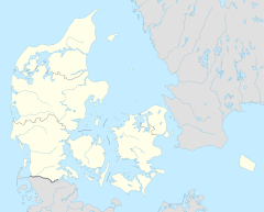
Højstrup railway halt
Appearance
Højstrup | |||||||||||
|---|---|---|---|---|---|---|---|---|---|---|---|
| railway halt | |||||||||||
 Højstrup halt in 2012 | |||||||||||
| General information | |||||||||||
| Location | Lappestensvej DK-3000 Helsingør[1] Helsingør Municipality Denmark | ||||||||||
| Coordinates | 56°02′53″N 12°35′36″E / 56.04806°N 12.59333°E | ||||||||||
| Elevation | 8.8 metres (29 ft)[1] | ||||||||||
| Owned by | Hovedstadens Lokalbaner | ||||||||||
| Operated by | Lokaltog | ||||||||||
| Line(s) | Hornbæk Line | ||||||||||
| Platforms | 2 | ||||||||||
| Tracks | 2 | ||||||||||
| History | |||||||||||
| Opened | 1906[1] | ||||||||||
| Services | |||||||||||
| |||||||||||
| |||||||||||
Højstrup railway halt is a railway halt serving the district Højstrup in the northern outskirts of the city of Helsingør, Denmark.[1]
The station is located on the Hornbæk Line from Helsingør to Gilleleje. The train services are currently operated by the railway company Lokaltog which runs frequent local train services between Helsingør station and Gilleleje station.
References
[edit]Citations
[edit]This article needs additional citations for verification. (October 2024) |
- ^ a b c d "Højstrup Trinbræt (Høp)". danskejernbaner.dk (in Danish). Retrieved 15 October 2024.
See also
[edit]External links
[edit]Wikimedia Commons has media related to Højstrup Trinbræt.


