Gunungapi Wetar
Appearance
| Gunungapi Wetar | |
|---|---|
 | |
| Highest point | |
| Elevation | 239 m (784 ft)[1] |
| Coordinates | 6°38′31″S 126°39′00″E / 6.642°S 126.65°E |
| Geography | |
 | |
| Location | Banda Sea, Indonesia |
| Geology | |
| Mountain type | Stratovolcano |
| Last eruption | 1699 |

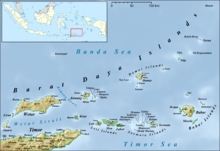
Gunungapi Wetar is an isolated volcanic island to the north of Wetar island in the Banda Sea, Indonesia. The island, a stratovolcano, only extends 239 m above sea level, but the total height of the summit from the sea bed is over 5000 m. Explosions in 1512 and 1699 are the only historical eruptions of the volcano.[1]
See also
[edit]References
[edit]- ^ a b "Gunungapi Wetar". Global Volcanism Program. Smithsonian Institution. Retrieved 2023-03-17.
