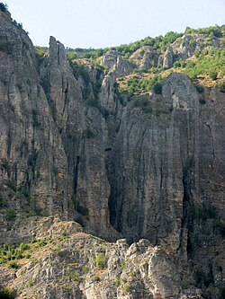
Grykë-Çajë
Appearance
Grykë-Çajë | |
|---|---|
 The Grykë-Çajë canyon | |
| Coordinates: 41°53′N 20°30′E / 41.883°N 20.500°E | |
| Country | |
| County | Kukës |
| Municipality | Kukës |
| Population (2023) | |
| • Municipal unit | 933 |
| Time zone | UTC+1 (CET) |
| • Summer (DST) | UTC+2 (CEST) |
| Postal Code | 8507 [1] |
Grykë-Çajë is a former municipality in Kukës County, Albania. At the 2015 local government reform it became a subdivision of the municipality Kukës.[2] The population at the 2023 census was 933.[3] It is located between two rivers that flow into the Black Drin river, at the foot of Mount Korab. Nine Halveti structures lie in the municipality's borders.[4]
The municipal unit consists of the following villages:[5]
- Fshat
- Çajë
- Buzëmadhe
- Shkinak
References
[edit]- ^ "ZIP Code database of Albania, Kukës, Kukës". Postal and ZIP Code database. London: GeoPostcodes Ltd. Retrieved February 12, 2011.
- ^ "Law nr. 115/2014" (PDF) (in Albanian). p. 6373. Retrieved 25 February 2022.
- ^ "Population and Housing Census, Kukës 2023" (PDF). INSTAT. p. 108. Retrieved 8 November 2024.
- ^ TARIKATI HALVETI LISTA E TEQEVE VITI 2005 Accessed 3 July 2017.
- ^ "Shoqata e Komunave te hqiperise" [Albanian Association of Municipalities]. Tiranë, Albania: Shoqata e Komunave te Shqiperise (SHKSH). Archived from the original on July 24, 2011. Retrieved February 12, 2011.


