Grade I listed buildings in West Devon
Appearance
There are over 9,000 Grade I listed buildings in England. This page is a list of these buildings in the district of West Devon in Devon.
West Devon
[edit]| Name | Location | Type | Completed [note 1] | Date designated | Grid ref.[note 2] Geo-coordinates |
Entry number [note 3] | Image |
|---|---|---|---|---|---|---|---|
| Church of St Andrew | Bere Ferrers, West Devon | Parish Church | no later than early 14th century | 21 March 1967 | SX4593563413 50°27′01″N 4°10′17″W / 50.450274°N 4.171457°W |
1163103 |  |
| Church of St James | Bondleigh, West Devon | Church | Dated 1706 | 22 February 1967 | SS6511504840 50°49′38″N 3°55′00″W / 50.827339°N 3.916556°W |
1326420 | 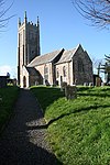 |
| Bradstone Manor Gatehouse and Flanking Walls | Bradstone, West Devon | Wall | circa late 16th century | 21 March 1967 | SX3816980885 50°36′19″N 4°17′18″W / 50.605183°N 4.288341°W |
1104827 | 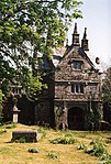 |
| Church of St Nonna | Bradstone, West Devon | Parish Church | circa 12th century origins | 21 March 1967 | SX3812380899 50°36′19″N 4°17′20″W / 50.605296°N 4.288997°W |
1326684 |  |
| Greystone Bridge | Bradstone, West Devon | Road Bridge | 1439 | 21 March 1967 | SX3684680344 50°36′00″N 4°18′24″W / 50.599953°N 4.306784°W |
1104822 | 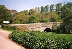 |
| Church of St Mary | Bratton Clovelly, West Devon | Parish Church | Early 14th century | 22 February 1967 | SX4636091821 50°42′20″N 4°10′38″W / 50.705672°N 4.177219°W |
1326312 |  |
| Church of St Michael De Rupe | Brent Tor, West Devon | Sundial | dated 1642 | 21 March 1967 | SX4707780403 50°36′12″N 4°09′44″W / 50.603255°N 4.162354°W |
1104836 | 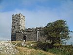 |
| Church of All Hallows | Broadwoodkelly, West Devon | Church | 18th century | 22 February 1967 | SS6174805860 50°50′09″N 3°57′53″W / 50.835711°N 3.964718°W |
1146659 | 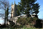 |
| Buckland Abbey | Buckland Monachorum, West Devon | Abbey | founded 1278 | 14 June 1952 | SX4872566783 50°28′53″N 4°08′01″W / 50.481287°N 4.13355°W |
1163369 |  |
| Church of St Andrew | Buckland Monachorum, West Devon | Parish Church | later 15th century | 21 March 1967 | SX4902268334 50°29′43″N 4°07′48″W / 50.495302°N 4.129994°W |
1326380 | 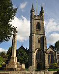 |
| Tithe Barn Directly to East of Buckland Abbey | Buckland Monachorum, West Devon | Tithe Barn | 15th century | 14 June 1952 | SX4876766778 50°28′53″N 4°07′59″W / 50.481252°N 4.132957°W |
1105493 |  |
| Church of St Michael | Chagford, West Devon | Church | 15th century | 22 February 1967 | SX7014687508 50°40′22″N 3°50′21″W / 50.672711°N 3.839046°W |
1308610 |  |
| Hole Farmhouse Including Garden Walls and Mounting Block Adjoining to North | Chagford, West Devon | Farmhouse | C20 | 20 February 1952 | SX6850786098 50°39′35″N 3°51′42″W / 50.659669°N 3.861727°W |
1106187 | 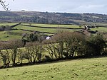 |
| Castle Drogo | Drewsteignton, West Devon | Country House | 1911-1930 | 20 February 1952 | SX7218490038 50°41′45″N 3°48′40″W / 50.695902°N 3.811096°W |
1106086 |  |
| Church of the Holy Trinity | Drewsteignton, West Devon | Parish Church | 15th century and early 16th century | 22 February 1967 | SX7363790849 50°42′13″N 3°47′27″W / 50.70351°N 3.790811°W |
1106073 | 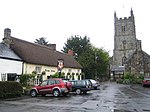 |
| Church of All Saints | Dunterton, West Devon | Stocks | circa 1460s | 21 March 1967 | SX3758379293 50°35′27″N 4°17′45″W / 50.590715°N 4.295919°W |
1163426 | 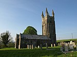 |
| Church of the Holy Trinity | Gidleigh, West Devon | Parish Church | Saxon or Norman | 22 February 1967 | SX6706288383 50°40′48″N 3°52′59″W / 50.679878°N 3.882981°W |
1106128 |  |
| Gidleigh Castle | Gidleigh, West Devon | Tower Keep | 13th century | 22 February 1967 | SX6703788426 50°40′49″N 3°53′00″W / 50.680259°N 3.88335°W |
1308353 |  |
| Morwell Barton | Gulworthy, West Devon | House | Late 12th century | 14 June 1952 | SX4456570790 50°30′58″N 4°11′38″W / 50.516206°N 4.193808°W |
1105738 |  Upload Photo |
| New Bridge | Gulworthy, West Devon | Bridge | c. 1520 | 21 March 1967 | SX4332172209 50°31′43″N 4°12′43″W / 50.528626°N 4.211937°W |
1172383 |  |
| Church of St John the Baptist | Hatherleigh, West Devon | Parish Church | late 15th century and early 16th century | 22 February 1967 | SS5411004599 50°49′21″N 4°04′21″W / 50.822502°N 4.072611°W |
1105250 | 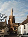 |
| Horrabridge Bridge | Horrabridge, West Devon | Bridge | c. 1400 | 14 June 1952 | SX5132769926 50°30′37″N 4°05′53″W / 50.510199°N 4.098153°W |
1105769 |  |
| Church of St James | Iddesleigh, West Devon | Parish Church | 13th century | 22 February 1967 | SS5690008226 50°51′21″N 4°02′04″W / 50.855794°N 4.034445°W |
1309051 | 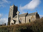 |
| Kelly House | Kelly, West Devon | House | 16th century | 14 June 1952 | SX3944681394 50°36′36″N 4°16′14″W / 50.610109°N 4.27053°W |
1318194 | 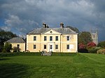 |
| Parish Church of St Mary | Kelly, West Devon | Parish Church | 14th century | 21 March 1967 | SX3951481400 50°36′37″N 4°16′10″W / 50.610182°N 4.269573°W |
1104815 | 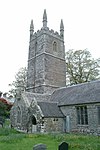 |
| Collacombe Manor | Lamerton, West Devon | Cross Passage House | Pre Reformation | 14 June 1952 | SX4308676450 50°34′00″N 4°13′01″W / 50.566673°N 4.217038°W |
1326224 |  Upload Photo |
| Parish Church of St Peter | Lewtrenchard, West Devon | Parish Church | Late 15th century | 7 November 1985 | SX4571786111 50°39′15″N 4°11′02″W / 50.654191°N 4.183934°W |
1326326 |  |
| Church of St Mary | Lifton, West Devon | Parish Church | 14th century | 21 March 1967 | SX3863485019 50°38′33″N 4°17′01″W / 50.642458°N 4.283575°W |
1317823 |  |
| Wortham | Lifton, West Devon | Cross Wing House | 15th century | 14 June 1952 | SX3820186957 50°39′35″N 4°17′26″W / 50.659752°N 4.290541°W |
1164234 |  |
| Church of St Mary | Mary Tavy, West Devon | Church | 14th century | 21 March 1967 | SX5092378749 50°35′22″N 4°06′27″W / 50.589387°N 4.107381°W |
1326217 |  |
| Church of St Mary | Marystow, West Devon | Parish Church | 12th century | 21 March 1967 | SX4346582862 50°37′28″N 4°12′52″W / 50.624394°N 4.214394°W |
1326319 | 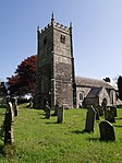 |
| Sydenham House | Sydenham, Marystow, West Devon | House | Earlier | 14 June 1952 | SX4281383855 50°37′59″N 4°13′26″W / 50.633142°N 4.224025°W |
1164731 |  |
| Church of St Peter | Meavy, West Devon | Parish Church | Norman | 21 March 1967 | SX5403767220 50°29′12″N 4°03′32″W / 50.486562°N 4.058902°W |
1105442 |  |
| Parish Church of St Constantine | Milton Abbot, West Devon | Church | 18th century | 21 March 1967 | SX4072579281 50°35′29″N 4°15′06″W / 50.591473°N 4.251562°W |
1326349 |  |
| Endsleigh House, Including Terrace Wall to the South East and Wall to the North East | Endsleigh, Milton Abbot, West Devon | House | Designed 1810 | 21 March 1967 | SX3910978596 50°35′06″N 4°16′27″W / 50.584874°N 4.274077°W |
1317513 |  |
| Retaining Wall to the Raised Garden to the South West of Endsleigh House | Endsleigh, Milton Abbot, West Devon | Garden Wall | c. 1810 | 7 November 1985 | SX3907678597 50°35′06″N 4°16′28″W / 50.584874°N 4.274543°W |
1326345 |  Upload Photo |
| Rockery and Grotto, Endsleigh Gardens | Endsleigh, Milton Abbot, West Devon | Grotto | c. 1810 | 7 November 1985 | SX3904378669 50°35′08″N 4°16′30″W / 50.585512°N 4.27504°W |
1165212 |  Upload Photo |
| Stables to the North of Endsleigh House | Endsleigh, Milton Abbot, West Devon | House | designed circa 1810 | 6 October 1982 | SX3910278633 50°35′07″N 4°16′27″W / 50.585205°N 4.274191°W |
1165172 |  Upload Photo |
| The Salmon Larder and Ice House, Endsleigh Gardens | Endsleigh, Milton Abbot, West Devon | Dairy | c. 1814 | 6 October 1982 | SX3894978671 50°35′08″N 4°16′35″W / 50.585504°N 4.276367°W |
1105548 |  |
| The Shell House and Grotto, Endsleigh Gardens | Endsleigh, Milton Abbot, West Devon | Wall | c. 1810 | 6 October 1982 | SX3924278453 50°35′01″N 4°16′20″W / 50.583626°N 4.272138°W |
1326346 |  Upload Photo |
| The Swiss Cottage, Endsleigh Gardens | Endsleigh, Milton Abbot, West Devon | House | late C20 | 19 October 1978 | SX3952578018 50°34′47″N 4°16′05″W / 50.579795°N 4.267956°W |
1105549 | 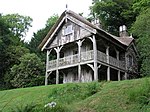 |
| Church of St Peter | North Tawton, West Devon | Parish Church | 13th century | 22 February 1967 | SS6644901722 50°47′59″N 3°53′47″W / 50.799625°N 3.89649°W |
1146842 |  |
| Church of St Thomas of Canterbury | Northlew, West Devon | Parish Church | Norman | 22 February 1967 | SX5050299173 50°46′22″N 4°07′18″W / 50.772821°N 4.121588°W |
1147443 |  |
| Okehampton Castle | Okehampton Hamlets, West Devon | Bailey | 13th century | 7 September 1987 | SX5834294249 50°43′50″N 4°00′31″W / 50.730538°N 4.008578°W |
1165647 | 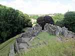 |
| Church of St Peter | Peter Tavy, West Devon | Parish Church | 14th century | 21 March 1967 | SX5131377773 50°34′51″N 4°06′05″W / 50.580716°N 4.101484°W |
1105400 | 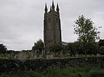 |
| Church of St Andrew | Sampford Courtenay, West Devon | Parish Church | 15th century | 22 February 1967 | SS6324101267 50°47′41″N 3°56′31″W / 50.794787°N 3.941816°W |
1105290 | 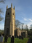 |
| Church of St Mary | Honeychurch, Sampford Courtenay, West Devon | Gate | 19th century | 22 February 1967 | SS6291302816 50°48′31″N 3°56′49″W / 50.808631°N 3.947045°W |
1105288 | 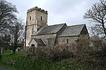 |
| Church of St Mary | Sampford Spiney, West Devon | Parish Church | Late C13/Early 14th century | 21 March 1967 | SX5342672471 50°32′01″N 4°04′10″W / 50.533601°N 4.069572°W |
1326222 |  |
| Church (dedication Unknown) | Sheepstor, West Devon | Parish Church | Late 15th century | 21 March 1967 | SX5601267653 50°29′27″N 4°01′52″W / 50.490943°N 4.031247°W |
1171232 |  |
| Church of St Andrew | South Tawton, West Devon | Parish Church | 15th century | 22 February 1967 | SX6530794482 50°44′03″N 3°54′36″W / 50.73429°N 3.910033°W |
1106035 |  |
| North Wyke | South Tawton, West Devon | Country House | 15th century | 20 February 1952 | SX6602198379 50°46′10″N 3°54′05″W / 50.769481°N 3.901341°W |
1170345 | 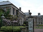 |
| Church of St John the Baptist | Stowford, West Devon | Parish Church | 14th century | 21 March 1967 | SX4326987021 50°39′42″N 4°13′08″W / 50.661714°N 4.218923°W |
1105532 |  |
| Horse Bridge | Horsebridge, Sydenham Damerel, West Devon | Road Bridge | Early 15th century | 14 June 1952 | SX4001274876 50°33′06″N 4°15′35″W / 50.551695°N 4.259731°W |
1165822 |  |
| Abbey Gatehouse | Tavistock, West Devon | Library | 1829 | 7 September 1951 | SX4820174422 50°32′59″N 4°08′39″W / 50.5498°N 4.14404°W |
1105833 |  |
| Betsy Grimbal's Tower, the Vicarage | Tavistock, West Devon | Tower | 15th century | 7 September 1951 | SX4811574330 50°32′56″N 4°08′43″W / 50.548951°N 4.145215°W |
1326209 | 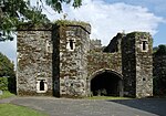 |
| Church of St Andrew | Tavistock, West Devon | Church | Norman | 7 September 1951 | SX4929672697 50°32′04″N 4°07′40″W / 50.534582°N 4.127897°W |
1326196 |  |
| Porch to Abbot's Hall in Grounds of Bedford Hotel | Tavistock, West Devon | Tower | late 15th century or early 16th century | 7 September 1951 | SX4816374351 50°32′57″N 4°08′40″W / 50.549152°N 4.144547°W |
1105820 |  |
| Remains of North-west Corner of Abbey Cloister and Church Wall in St Eustachius' Churchyard | Tavistock, West Devon | Wall | 13th century | 7 September 1951 | SX4812974386 50°32′58″N 4°08′42″W / 50.549458°N 4.14504°W |
1162792 | 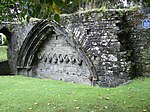 |
| Church of St Mary the Virgin | Throwleigh, West Devon | Parish Church | late 13th century - early 14th century | 22 February 1967 | SX6677190775 50°42′05″N 3°53′17″W / 50.701311°N 3.88796°W |
1168195 | 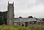 |
| Higher Shilstone Farmhouse Including Stables and Garden Walls Adjoining to South | Throwleigh, West Devon | Dairy | Late 17th century | 20 February 1952 | SX6602590085 50°41′42″N 3°53′54″W / 50.694938°N 3.898267°W |
1307205 |  Upload Photo |
| Church of St George | Thrushelton, West Devon | Parish Church | 13th century | 21 March 1967 | SX4473787609 50°40′03″N 4°11′54″W / 50.667392°N 4.198416°W |
1105510 |  |
| Church of St Mary | Walkhampton, West Devon | Parish Church | Pre 15th century | 21 March 1967 | SX5366270150 50°30′46″N 4°03′55″W / 50.512801°N 4.065333°W |
1105371 |  |
| Walreddon Manor | Whitchurch, West Devon | House | Early/Mid 17th century | 21 March 1967 | SX4775871315 50°31′18″N 4°08′56″W / 50.521764°N 4.149018°W |
1105714 |  Upload Photo |
Notes
[edit]- ^ The date given is the date used by Historic England as significant for the initial building or that of an important part in the structure's description.
- ^ Sometimes known as OSGB36, the grid reference is based on the British national grid reference system used by the Ordnance Survey.
- ^ The "List Entry Number" is a unique number assigned to each listed building and scheduled monument by Historic England.
