Gråborg
Appearance
| Gråborg | |
|---|---|
| Sweden | |
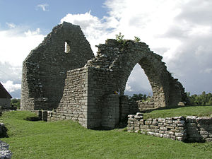
 Ruins of St. Knut chapel | |
| Coordinates | 56°40′0″N 16°36′12″E / 56.66667°N 16.60333°E |
Gråborg is the ruin of a castle in Öland, Sweden. It is located in Algutsrum parish in Mörbylånga Municipality. The oldest parts of the ancient castle are probably from the 5th century. The castle was expanded in stages into the 12th century. During the Middle Ages, Gråborg was probably utilized as a protected marketplace. It was the site of St. Knut chapel, which is also in ruins. [1]
Gallery
[edit]See also
[edit]References
[edit]- ^ "Gråborg, Algutsrum socken". Kalmar läns museum. Retrieved September 1, 2020.


