Gortina
Appearance
Gortina | |
|---|---|
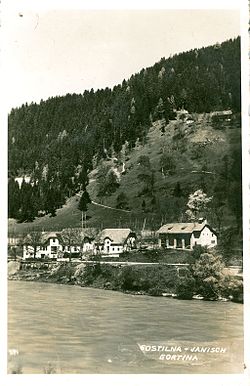
 1935 postcard of Gortina | |
| Coordinates: 46°36′18.94″N 15°7′28.85″E / 46.6052611°N 15.1246806°E | |
| Country | |
| Traditional region | Styria |
| Statistical region | Carinthia |
| Municipality | Muta |
| Area | |
| • Total | 6.88 km2 (2.66 sq mi) |
| Elevation | 367.4 m (1,205.4 ft) |
| Population (2002) | |
| • Total | 563 |
| [1] | |
Gortina (pronounced [ɡɔɾˈtiːna]) is a village on the left bank of the Drava River in the Municipality of Muta in the historical Styria region in northern Slovenia.[2]
There is a small church in the settlement with a wooden belfry. It is dedicated to Saint Stephen and was built in the early 18th century. It belongs to the Parish of Muta.[3]
References
[edit]External links
[edit]


