Gomotartsi Knoll
Appearance

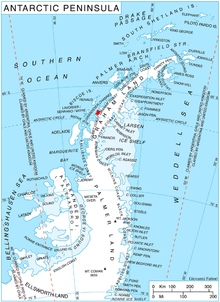
Gomotartsi Knoll (Bulgarian: Гомотарска могила, ‘Gomotarska Mogila’ \go-mo-'tar-ska mo-'gi-la\) is the rocky, mostly ice-covered peak of elevation 942 m[1] in the south part of Widmark Ice Piedmont on Stresher Peninsula, Loubet Coast in Graham Land, Antarctica. It is named after the settlement of Gomotartsi in Northwestern Bulgaria.
Location
[edit]
Gomotartsi Knoll is located at 66°20′36″S 65°30′10″W / 66.34333°S 65.50278°W, which is 17.7 km east-southeast of Cape Bellue, 6.3 km west-southwest of Rugg Peak and 7.78 km northwest of Mount Lyttleton. British mapping in 1976.
Maps
[edit]- Antarctic Digital Database (ADD). Scale 1:250000 topographic map of Antarctica. Scientific Committee on Antarctic Research (SCAR). Since 1993, regularly upgraded and updated.
- British Antarctic Territory. Scale 1:200000 topographic map. DOS 610 Series, Sheet W 66 64. Directorate of Overseas Surveys, Tolworth, UK, 1976.
Notes
[edit]| REMA Explorer |
|---|
The Reference Elevation Model of Antarctica (REMA) gives ice surface measurements of most of the continent. When a feature is ice-covered, the ice surface will differ from the underlying rock surface and will change over time. To see ice surface contours and elevation of a feature as of the last REMA update,
|
- ^ Reference Elevation Model of Antarctica. Polar Geospatial Center. University of Minnesota, 2019
References
[edit]- Bulgarian Antarctic Gazetteer. Antarctic Place-names Commission. (details in Bulgarian, basic data in English)
- Gomotartsi Knoll. SCAR Composite Antarctic Gazetteer.
External links
[edit]- Gomotartsi Knoll. Copernix satellite image
This article includes information from the Antarctic Place-names Commission of Bulgaria which is used with permission.
