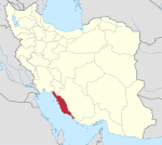
Golestan, Bushehr
Appearance
Golestan
Persian: گلستان | |
|---|---|
Former Village | |
| Coordinates: 28°02′08″N 52°04′24″E / 28.03556°N 52.07333°E[1] | |
| Country | |
| Province | Bushehr |
| County | Jam |
| District | Riz |
| Rural District | Anarestan |
| Population (2006)[2] | |
• Total | 316 |
| Time zone | UTC+3:30 (IRST) |
Golestan (Persian: گلستان)[a] was a village in Anarestan Rural District of Riz District, Jam County, Bushehr province, Iran.
Demographics
[edit]Population
[edit]At the time of the 2006 National Census, the village's population was 316 in 63 households.[2]
After the census, the village of Anarestan merged with Golestan and was elevated to the status of a city.[4]
See also
[edit]Notes
[edit]References
[edit]- ^ OpenStreetMap contributors (27 August 2024). "Golestan, Jam County" (Map). openstreetmap.org (OpenStreetMap) (in Persian). Retrieved 27 August 2024.
- ^ a b Census of the Islamic Republic of Iran, 1385 (2006): Bushehr Province. amar.org.ir (Report) (in Persian). The Statistical Center of Iran. Archived from the original (Excel) on 20 September 2011. Retrieved 25 September 2022.
- ^ Golestan can be found at GEOnet Names Server, at this link, by opening the Advanced Search box, entering "-3064235" in the "Unique Feature Id" form, and clicking on "Search Database".
- ^ Rahimi, Mohammad Reza (c. 2023) [Approved 26 July 1388]. Approval letter regarding the merger of Anarestan and Golestan villages from Anarestan Rural District of Jam County in Bushehr province to the city of Anarestan. lamtakam.com (Report) (in Persian). Ministry of the Interior, Political and Defense Commission. Notification 147994/T41299K. Archived from the original on 1 December 2023. Retrieved 1 December 2023 – via Lam ta Kam.


