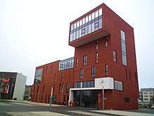
Gmina Siechnice
Gmina Siechnice
Siechnice Commune | |
|---|---|
 | |
| Coordinates (Siechnice): 51°2′N 17°9′E / 51.033°N 17.150°E | |
| Country | |
| Voivodeship | Lower Silesian |
| County | Wrocław |
| Seat | Siechnice |
| Area | |
• Total | 98.57 km2 (38.06 sq mi) |
| Population (2019-06-30[1]) | |
• Total | 22,396 |
| • Density | 230/km2 (590/sq mi) |
| • Urban | 8,113 |
| • Rural | 14,283 |
| Website | http://www.siechnice.gmina.pl/ |

Gmina Siechnice is an urban-rural gmina (administrative district) in Wrocław County, Lower Silesian Voivodeship, in south-western Poland. Its seat is the town of Siechnice, which lies approximately 13 kilometres (8 mi) south-east of the county and regional capital, Wrocław. It is part of the Wrocław metropolitan area.
Until 1 January 2010 the gmina was called Gmina Święta Katarzyna, and had its seat in the village of Święta Katarzyna, which is just to the west of Siechnice. (Now the only urban-rural gmina in Poland to have its seat in a village rather than its town is Gmina Nowe Skalmierzyce.)
The gmina covers an area of 98.57 square kilometres (38.1 sq mi), and as of 2019 its total population is 22,396.
Neighbouring gminy
[edit]Gmina Siechnice is bordered by the city of Wrocław and by the gminas of Czernica, Domaniów, Kobierzyce, Oława and Żórawina.
Villages
[edit]Apart from the town of Siechnice, the gmina contains the villages of Biestrzyków, Blizanowice, Bogusławice, Durok, Groblice, Grodziszów, Iwiny, Kotowice, Łukaszowice, Mokry Dwór, Ozorzyce, Radomierzyce, Radwanice, Smardzów, Sulęcin, Sulimów, Święta Katarzyna, Szostakowice, Zacharzyce, Zębice and Żerniki Wrocławskie.
References
[edit]- ^ "Population. Size and structure and vital statistics in Poland by territorial division in 2019. As of 30th June". stat.gov.pl. Statistics Poland. 2019-10-15. Retrieved 2020-02-14.


