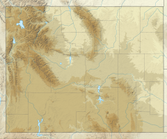
Glacier Falls (Teton County, Wyoming)
Appearance
| Glacier Falls | |
|---|---|
 | |
| Location | Grand Teton National Park, United States |
| Coordinates | 43°43′45″N 110°45′33″W / 43.729108°N 110.759298°W[1] |
| Type | Cascade |
| Total height | 300 feet (91 m) |
| Watercourse | Intermittent stream |
Glacier Falls is a cascade located in Glacier Gulch, Grand Teton National Park in the U.S. state of Wyoming.[2] It drops approximately 300 feet (91 m) in Glacier Gulch, fed by runoff from the Teton Glacier. More than .5 miles (0.80 km) below Delta Lake, it is a highly intermittent waterfall, usually at peak flow during the late spring and early summer snowmelt.
References
[edit]- ^ "Glacier Falls". Geographic Names Information System. United States Geological Survey, United States Department of the Interior. Retrieved 2012-05-26.
- ^ Grand Teton, WY (Map). Topoquest (USGS Quads). Retrieved 2012-05-26.

