George Town Airport
Appearance
George Town Airport | |||||||||||
|---|---|---|---|---|---|---|---|---|---|---|---|
| Summary | |||||||||||
| Airport type | Public | ||||||||||
| Serves | Great Exuma, Bahamas | ||||||||||
| Location | George Town | ||||||||||
| Elevation AMSL | 5 ft / 2 m | ||||||||||
| Coordinates | 23°28′00″N 075°46′54″W / 23.46667°N 75.78167°W | ||||||||||
| Map | |||||||||||
 | |||||||||||
| Runways | |||||||||||
| |||||||||||
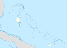
George Town Airport (ICAO: MYEG) is an abandoned airport located near George Town on the island of Great Exuma in The Bahamas[1] which is closed for civilian use.[3]
Facilities
[edit]The closed airport, located at the end of "Old Airport Road" on Great Exuma Island, resides at an elevation of 5 ft (1.5 m) above mean sea level. It had one runway designated 11/29 with an asphalt surface measuring 1,524 m × 27 m (5,000 ft × 89 ft).[1]


Accidents and incidents
[edit]- On 3 February 1998, Douglas C-47A N200MF of Missionary Flights International crashed on approach to George Town Airport. The aircraft was on a passenger flight from Cap-Haitien International Airport, Haiti when an engine failed shortly after take-off. The crew decided to return to George Town but the second engine failed on approach. All 26 on board survived.[4][5]
See also
[edit]- Exuma International Airport (IATA: GGT, ICAO: MYEF), located near Moss Town.
References
[edit]- ^ a b c "Airport information for MYEG". World Aero Data. Archived from the original on 2019-03-05.
{{cite web}}: CS1 maint: unfit URL (link) Data current as of October 2006. Source: DAFIF. - ^ Airport information for MYEG at Great Circle Mapper. Source: DAFIF (effective October 2006).
- ^ Cleare, Angela B. (2016). Business of Travel and Tourism in the 21st Century: A Caribbean Approach. Lulu.com. ISBN 978-1-4834-5058-2.
- ^ "N200MF Accident description". Aviation Safety Network. Retrieved 25 June 2010.
- ^ "MIA98WA068". National Transportation Safety Board. Retrieved 29 June 2010.

