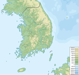
Geomdansan (Seongnam and Gwangju)
Appearance
You can help expand this article with text translated from the corresponding article in Korean. (April 2015) Click [show] for important translation instructions.
|
| Geomdansan | |
|---|---|
| Highest point | |
| Elevation | 534.7 m (1,754 ft) |
| Coordinates | 37°27′31″N 127°11′02″E / 37.4586°N 127.184°E |
| Geography | |
| Location | Seongnam & Gwangju, South Korea |
| Korean name | |
| Hangul | 검단산 |
| Hanja | |
| Revised Romanization | Geomdansan |
| McCune–Reischauer | Kŏmdansan |
Geomdansan (Korean: 검단산) is a mountain located in Seongnam, and Gwangju, Gyeonggi Province, South Korea. It has an elevation of 534.7 m (1,754 ft).[1]
See also
[edit]- Geography of Korea
- List of mountains in Korea
- List of mountains by elevation
- Mountain portal
- South Korea portal
References
[edit]- ^ "성남 검단산 프리라이딩 코스". Senior Chosun News. 11 January 2006. Retrieved 5 July 2013.

