Gdańsk Old Town
Appearance
Stare Miasto | |
|---|---|
Part of Gdańsk | |
 Skyline of the Old Town | |
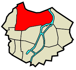
 Location of Stare Miasto within Śródmieście, Gdańsk | |
| Coordinates: 54°21′14″N 18°38′55″E / 54.3539°N 18.6486°E | |
| Country | |
| Voivodeship | Pomeranian |
| County/City | Gdańsk |
| District | Śródmieście |
| Time zone | UTC+1 (CET) |
| • Summer (DST) | UTC+2 (CEST) |
| Vehicle registration | GD |
| Designated | 1994-09-08 |
| Part of | Gdańsk – city within the 17th-century fortifications |
| Reference no. | M.P. 1994 nr 50 poz. 415[1] |
This article needs additional citations for verification. (February 2024) |
Old Town (Polish: Stare Miasto, German: Altstadt) in Gdańsk is the oldest part of the city, located in the northern part of the Śródmieście district (city center).
The Old Town borders with the districts of Aniołki and Młyniska in the north, and with other parts of the Śródmieście: the Sienna Grobla in the east, the Main City, Ołowianka Island and Nowe Ogrody in the south, and Grodzisko in the west.
Sights
[edit]Notable structures include:
- Gdańsk Mills
- Old Town Hall[2]
- St. Catherine's Church
- Gdańsk Główny railway station, the main station of Gdańsk
- Monument of King John III Sobieski
- Polish Post Office and Monument of the Defenders of the Polish Post Office
- Mannerist Preachers' House
- Mannerist House of the Abbots of Pelplin
- Monument of Jan Heweliusz
- Monument to the Fallen Shipyard Workers of 1970
- Gdańsk Library of Polish Academy of Sciences
Museums
[edit]- Museum of the Polish Post (Muzeum Poczty Polskiej)
- Museum of Tower Clocks (Muzeum Zegarów Wieżowych)
- Museum of the Second World War
Gallery
[edit]-
Old Town Hall
-
Radunia Canal and St. Catherine's Church
References
[edit]- ^ Zarządzenie Prezydenta Rzeczypospolitej Polskiej z dnia 8 września 1994 r. w sprawie uznania za pomnik historii., M.P., 1994, vol. 50, No. 415
- ^ "History of Old Town Hall | Nadbałtyckie Centrum Kultury w Gdańsku". www.nck.org.pl. Retrieved 2024-02-22.


