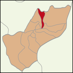
Gazi Mustafa Kemal Paşa, Çerkezköy
Appearance
Gazi Mustafa Kemal Paşa | |
|---|---|
 Location within Çerkezköy District | |
| Coordinates: 41°17′20″N 28°00′13″E / 41.2888°N 28.0035°E | |
| Country | Turkey |
| Province | Tekirdağ |
| District | Çerkezköy |
| Elevation | 150 m (490 ft) |
| Population (2022) | 21,297 |
| Time zone | UTC+3 (TRT) |
| Postal code | 59500[1] |
| Area code | 0282 |
Gazi Mustafa Kemal Paşa is a neighbourhood of the municipality and district of Çerkezköy, Tekirdağ Province, Turkey.[2][3] Its population is 21,297 (2022).[4] It covers part of the town centre of Çerkezköy. Distance to Tekirdağ is about 55 kilometres (34 mi).[5]
References
[edit]- ^ "Postal Codes Cerkezkoy ". Bulurum.com. Retrieved 1 March 2020.
- ^ Mahalle, Turkey Civil Administration Departments Inventory. Retrieved 19 September 2023.
- ^ "Neighborhoods of Çerkezköy". Municipality of Cerkezkoy. Retrieved 1 March 2020.
- ^ "Address-based population registration system (ADNKS) results dated 31 December 2022, Favorite Reports" (XLS). TÜİK. Retrieved 19 September 2023.
- ^ "Geographical information of Çerkezköy". Municipality of Çerkezköy. Archived from the original on 24 August 2019. Retrieved 28 February 2020.
External links
[edit]


