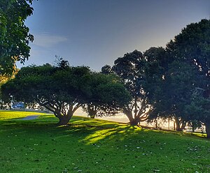
Gate Pa
Gate Pa | |
|---|---|
 Gate Pa Park | |
 | |
| Coordinates: 37°42′58″S 176°08′20″E / 37.716°S 176.139°E | |
| Country | New Zealand |
| City | Tauranga |
| Local authority | Tauranga City Council |
| Electoral ward | Te Papa General Ward |
| Area | |
| • Land | 176 ha (435 acres) |
| Population (June 2024)[2] | |
| • Total | 4,200 |
| Bethlehem | Judea | Tauranga South |
|
|
Merivale | |
| Tauriko | Greerton |
Gate Pa or Gate Pā is a suburb of Tauranga, in the Bay of Plenty Region of New Zealand's North Island.
It is the location of the Battle of Gate Pā in the 1864 Tauranga campaign of the New Zealand Wars.
Demographics
[edit]Gate Pa covers 1.76 km2 (0.68 sq mi)[1] and had an estimated population of 4,200 as of June 2024,[2] with a population density of 2,386 people per km2.
| Year | Pop. | ±% p.a. |
|---|---|---|
| 2006 | 3,543 | — |
| 2013 | 3,627 | +0.34% |
| 2018 | 4,023 | +2.09% |
| Source: [3] | ||

Before the 2023 census, Gate Pa had a larger boundary, covering 2.08 km2 (0.80 sq mi).[1] Using that boundary, Gate Pa had a population of 4,023 at the 2018 New Zealand census, an increase of 396 people (10.9%) since the 2013 census, and an increase of 480 people (13.5%) since the 2006 census. There were 1,341 households, comprising 2,034 males and 1,989 females, giving a sex ratio of 1.02 males per female. The median age was 31.4 years (compared with 37.4 years nationally), with 903 people (22.4%) aged under 15 years, 1,017 (25.3%) aged 15 to 29, 1,632 (40.6%) aged 30 to 64, and 474 (11.8%) aged 65 or older.
Ethnicities were 67.5% European/Pākehā, 29.5% Māori, 8.0% Pacific peoples, 10.9% Asian, and 2.2% other ethnicities. People may identify with more than one ethnicity.
The percentage of people born overseas was 18.7, compared with 27.1% nationally.
Although some people chose not to answer the census's question about religious affiliation, 49.0% had no religion, 32.1% were Christian, 3.9% had Māori religious beliefs, 1.9% were Hindu, 0.8% were Muslim, 0.4% were Buddhist and 4.0% had other religions.
Of those at least 15 years old, 405 (13.0%) people had a bachelor's or higher degree, and 648 (20.8%) people had no formal qualifications. The median income was $27,300, compared with $31,800 nationally. 192 people (6.2%) earned over $70,000 compared to 17.2% nationally. The employment status of those at least 15 was that 1,590 (51.0%) people were employed full-time, 441 (14.1%) were part-time, and 168 (5.4%) were unemployed.[3]
Economy
[edit]The Gate Pa Shopping Centre opened in 2006 and covers 10,000 m². It has 450 carparks and 21 shops, including Mitre 10 Mega and Spotlight.[4]
Education
[edit]Gate Pa School is a co-educational state primary school for Year 1 to 6 students,[5][6] with a roll of 354 as of August 2024.[7]
Tauranga Girls' College is a co-educational state girls' secondary school established in 1958,[8][9] with a roll of 1426.[10]
References
[edit]- ^ a b c "ArcGIS Web Application". statsnz.maps.arcgis.com. Retrieved 29 March 2024.
- ^ a b "Aotearoa Data Explorer". Statistics New Zealand. Retrieved 26 October 2024.
- ^ a b "Statistical area 1 dataset for 2018 Census". Statistics New Zealand. March 2020. Gate Pa (194600). 2018 Census place summary: Gate Pa
- ^ "Gate Pa Shopping Centre". jwlinvestments.co.nz. JWL Investments.
- ^ "Gate Pa School Official School Website". gatepa.school.nz.
- ^ "Gate Pa School Ministry of Education School Profile". educationcounts.govt.nz. Ministry of Education.
- ^ "Gate Pa School Education Review Office Report". ero.govt.nz. Education Review Office. Archived from the original on 30 January 2019. Retrieved 12 March 2020.
- ^ "Tauranga Girls' College Official School Website". tgc.school.nz.
- ^ "Tauranga Girls' College Ministry of Education School Profile". educationcounts.govt.nz. Ministry of Education.
- ^ "Tauranga Girls' College Education Review Office Report". ero.govt.nz. Education Review Office. Archived from the original on 24 January 2019. Retrieved 12 March 2020.
