Gamba Airport
Appearance
Gamba Airport Aéroport Gamba | |||||||||||
|---|---|---|---|---|---|---|---|---|---|---|---|
 Terminal | |||||||||||
| Summary | |||||||||||
| Owner/Operator | Shell Gabon | ||||||||||
| Location | Gamba | ||||||||||
| Elevation AMSL | 30 ft / 9 m | ||||||||||
| Coordinates | 02°47′07″S 10°02′50″E / 2.78528°S 10.04722°E | ||||||||||
| Map | |||||||||||
 | |||||||||||
| Runways | |||||||||||
| |||||||||||
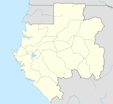
Gamba Airport (French: Aéroport Gamba) (IATA: GAX, ICAO: FOGX) is an airport serving Gamba, Gabon. The airport is near the Yenzi camp,[4] 7 kilometres (4.3 mi) southeast of Gamba.
See also
[edit]References
[edit]- ^ Gamba SCD Aviation
- ^ Airport information for Gamba Airport at Great Circle Mapper.
- ^ Google Maps - Gamba
- ^ "A day of Yenzi life – Living in a small compound in Gabon". Expatriate Archive Centre. 2016-06-16. Retrieved 2018-08-20.
External links
[edit]- OurAirports - Gamba
- FallingRain - Gamba Airport
- Accident history for Gamba Airport at Aviation Safety Network

