Frasin
Frasin | |
|---|---|
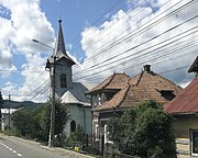
 Downtown Frasin | |
 Location in Suceava County | |
| Coordinates: 47°31′6″N 25°46′55″E / 47.51833°N 25.78194°E | |
| Country | Romania |
| County | Suceava |
| Government | |
| • Mayor (2020–2024) | Marinel Bălan[1] (PNL) |
| Area | 87.31 km2 (33.71 sq mi) |
| Elevation | 505 m (1,657 ft) |
| Population (2021-12-01)[2] | 5,817 |
| • Density | 67/km2 (170/sq mi) |
| Time zone | EET/EEST (UTC+2/+3) |
| Postal code | 727245 |
| Area code | (+40) 02 30 |
| Vehicle reg. | SV |
| Website | www |
| Year | Pop. | ±% |
|---|---|---|
| 2002 | 6,532 | — |
| 2011 | 5,702 | −12.7% |
| 2021 | 5,817 | +2.0% |
| Source: Census data | ||
Frasin (German: Frassin or Fraßin) is a town in Suceava County, mountainous northeastern Romania. It is situated in the historical region of Bukovina. Frasin is the thirteenth-largest urban settlement in the county, with a population of 5,817 according to the 2021 census. It was declared a town in 2004, along with seven other localities in Suceava County. The town administers the former village of Bucșoaia (which became a neighborhood in 2004), Doroteia, and Plutonița (with the status of associated villages).
Administration and local politics
[edit]Town council
[edit]The town's current local council has the following political composition, according to the results of the 2020 Romanian local elections:[3]
| Party | Seats | Current Council | |||||
|---|---|---|---|---|---|---|---|
| National Liberal Party (PNL) | 5 | ||||||
| People's Movement Party (PMP) | 3 | ||||||
| Save Romania Union (USR) | 3 | ||||||
| Social Democratic Party (PSD) | 2 | ||||||
| PRO Romania (PRO) | 1 | ||||||
| National Unity Block (BUN) | 1 | ||||||
Geography
[edit]Frasin is surrounded by the Bukovina Ridges of the Obcinele Mari, on the banks of Moldova River, between Câmpulung Moldovenesc and Gura Humorului, on European route E58. The town of Gura Humorului is only 7 km away. Frasin is connected to the Romanian national railway system and has a railway station on the Suceava–Vatra Dornei railway.
History
[edit]
In 1785, Frasin was known as a hamlet. One big step towards good development for Frasin took place in 1816 when a potassium factory was built. Frasin was declared a town in 1850.
Until 1918, Frasin was part of the Austrian monarchy (the province of Bukovina remained an Austrian crown land (German: Kronland) after the compromise of 1867), in the Câmpulung district, one of the 9 Bezirkshauptmannschaften of the province.[4]
Tourism
[edit]Frasin is located in the historical region of Bukovina where visitors can admire a whole number of painted medieval churches with World Heritage status. One of the most popular is Voroneț Monastery, built in 1488. Another asset of the area are the nature reserves like the primeval forest of Slătioara ("Codrul secular Slătioara") and the forests of the Giumalău Mountains.
Natives
[edit]- Radu Mareș (1941–2016), prose writer and journalist
Notes
[edit]- ^ "Results of the 2020 local elections". Central Electoral Bureau. Archived from the original on 9 October 2020. Retrieved 9 June 2021.
- ^ "Populaţia rezidentă după grupa de vârstă, pe județe și municipii, orașe, comune, la 1 decembrie 2021" (XLS). National Institute of Statistics.
- ^ "Rezultatele finale ale alegerilor locale din 2020" (in Romanian). Autoritatea Electorală Permanentă. Archived from the original (Json) on 2021-10-06. Retrieved 2020-11-02.
- ^ Die postalischen Abstempelungen auf den österreichischen Postwertzeichen-Ausgaben 1867, 1883 und 1890, Wilhelm Klein, 1967
External links
[edit]- (in Romanian) Frasin Town Hall official site
- (in Romanian) Frasin School Archived 2018-09-06 at the Wayback Machine
- (in Romanian) Suceava County site – Frasin web page


