Französische Straße (Berlin U-Bahn)
 Platform view of Französische Straße | ||||||||||||||||
| General information | ||||||||||||||||
| Location | Mitte | |||||||||||||||
| Owned by | Berliner Verkehrsbetriebe | |||||||||||||||
| Operated by | Berliner Verkehrsbetriebe | |||||||||||||||
| Platforms | 1 island platform | |||||||||||||||
| Tracks | 2 | |||||||||||||||
| Train operators | Berliner Verkehrsbetriebe | |||||||||||||||
| Connections | ||||||||||||||||
| Other information | ||||||||||||||||
| Fare zone | VBB: Berlin A/5555[1] | |||||||||||||||
| History | ||||||||||||||||
| Opened | 30 January 1923 | |||||||||||||||
| Closed | 3 December 2020 | |||||||||||||||
| Services | ||||||||||||||||
| ||||||||||||||||
 | ||||||||||||||||
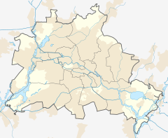
Französische Straße was a Berlin U-Bahn underground station on the U6 line located under the street Friedrichstraße in central Berlin.
This station was built by Grenander/Fehse/Jennen and opened in 1923. In 1945 it closed for a few months; it was closed in 1961. During the Cold War (1961–1990), the station became a ghost station. The station was closed to passenger traffic, and the underground trains of the West Berlin BVG passed the island platform in East Berlin slowly without stopping. In 1990, after the Berlin Wall fell, the station became accessible again. In 1995, the platform had to be lengthened by 25 m (82 ft) so that the longer, six-car trains could stop there.[2] It is the only former partition-related ghost station in Berlin to have since been closed a second time, albeit for different reasons.
2020 closure
[edit]With the opening of the expanded U5 line connecting Alexanderplatz with Berlin Hauptbahnhof, Französische Straße station was closed and replaced by the newly built Unter den Linden station directly to the north,[3] allowing transfers between the U6 and U5 lines. The last trains called at Französische Straße on 3 December 2020, with Unter den Linden station opening the following day.
References
[edit]- ^ "Der VBB-Tarif: Aufteilung des Verbundgebietes in Tarifwaben und Tarifbereiche" (PDF). Verkehrsbetrieb Potsdam. Verkehrsverbund Berlin-Brandenburg. 1 January 2017. Archived from the original (PDF) on 27 October 2020. Retrieved 25 November 2019.
- ^ J. Meyer-Kronthaler: Berlins U-Bahnhöfe. be.bra Verlag (1996)
- ^ "FAQ - Frequently Asked Questions". Projektrealisierungs GmbH U5. Retrieved 29 June 2017.


