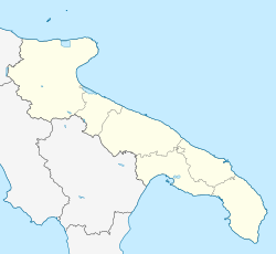
Francavilla Fontana
You can help expand this article with text translated from the corresponding article in Italian. (August 2014) Click [show] for important translation instructions.
|
Francavilla Fontana | |
|---|---|
| Comune di Francavilla Fontana | |
 View of the "Umberto I" square | |
 Francavilla within the Province of Brindisi | |
| Coordinates: 40°32′N 17°35′E / 40.533°N 17.583°E | |
| Country | Italy |
| Region | Apulia |
| Province | Brindisi (BR) |
| Frazioni | Bax Capece |
| Government | |
| • Mayor | Antonello Denuzzo |
| Area | |
| • Total | 175 km2 (68 sq mi) |
| Elevation | 142 m (466 ft) |
| Population | |
| • Total | 36,358 |
| • Density | 210/km2 (540/sq mi) |
| Demonym | Francavillesi |
| Time zone | UTC+1 (CET) |
| • Summer (DST) | UTC+2 (CEST) |
| Postal code | 72021 |
| Dialing code | 0831 |
| Patron saint | Madonna della Fontana |
| Saint day | September 14 |
| Website | Official website |

Francavilla Fontana (Francavillese: Francaìdda [fɾaŋkaˈiɖɖa]) is a town and comune (municipality) in the province of Brindisi and region of Apulia, in southern Italy. It is also called the town of the "Imperiali", after the Imperiali, a family of feudal lords who ruled the town from the end of 16th century until the 18th century. With a population of 36,358, in 2017,[2][3] it is the third municipality of its province after Brindisi and Fasano. Its one of the many towns in south Italy where the Greek dialect Griko is spoken.
History
[edit]The name Francavilla has French-Norman origins: "Franca" (tax-free) and "villa" (town). The specification Fontana ("fountain") alludes to a vision of the Virgin Mary witnessed by Prince Filippo d'Angiò, who hence declaring the town a tax-free haven, according to the local legend.
Geography
[edit]Francavilla is located in the Altosalento, on the last Murge's hills, and it is equidistant, about 35 kilometres (22 mi), from Taranto and Brindisi. The municipality borders with Ceglie Messapica, Grottaglie, Latiano, Manduria, Oria, San Marzano di San Giuseppe, San Michele Salentino, San Vito dei Normanni, Sava and Villa Castelli.[4]
Main sights
[edit]- The massive square Castle (Palazzo Imperiali) of the Imperiali family, to whom, with Oria, it was sold by St. Charles Borromeo in the 16th century for 40,000 ounces of gold, which he distributed in one day to poor and plague-infected people in Milan.[5]
- Mother Church, built from 1743 over a former Angevine construction.
- Torre dell'Orologio (watchtower), built in 1750.
Transport
[edit]The town, 18 km east of Taranto-Grottaglie Airport, is served by the SS7 "Appia" highway. The local railway station is a junction point between the lines Taranto–Brindisi, owned by the national company FS, and Martina–Lecce, owned by FSE. It is served by regional and, on the Taranto-Brindisi line, by long-distance trains also.
Sport
[edit]The local football club is the Virtus Francavilla, that has its home ground in John Paul II Stadium.
People
[edit]- Giovanni Manfredi (b. 2006), loka player
- Ottaviano Andriani (b. 1974), marathon runner
- Cosimo Caliandro (1982–2011), middle-distance runner
- Clementina Forleo (b. 1963), judge
- Giuseppe Renato Imperiali (1651–1737), cardinal
- Michele Imperiali Simeana (1736–1782), prince
- Giacomo Leone (b. 1971), long-distance runner
- Francesco Ribezzo (b. 8 May 1875, died Lecce, 19 October 1952), glottologist - the science of tongues or languages; comparative philology, particularly the dialect of F. Fontana
Twin towns
[edit] San Giovanni al Natisone, Italy
See also
[edit]References
[edit]- ^ "Superficie di Comuni Province e Regioni italiane al 9 ottobre 2011". Italian National Institute of Statistics. Retrieved 16 March 2019.
- ^ a b (in Italian) Source Archived 2017-06-26 at the Wayback Machine: ISTAT 2016
- ^ a b (in Italian) Population statistics of Francavilla Fontana (tuttaitalia.it). Data from ISTAT
- ^ 40522 Francavilla Fontana on OpenStreetMap
- ^ One or more of the preceding sentences incorporates text from a publication now in the public domain: Chisholm, Hugh, ed. (1911). "Francavilla Fontana". Encyclopædia Britannica. Vol. 10 (11th ed.). Cambridge University Press. p. 775.
External links
[edit]- (in Italian) Official website
- "Francavilla Fontana". Brindisi Virtual Tour (in Italian). Archived from the original on 24 May 2009. Retrieved 25 March 2008.


