Flitwick Castle
Appearance
| Flitwick Castle | |
|---|---|
| Flitwick, Bedfordshire, England | |
 Flitwick Castle earthworks, 2007 | |
| Coordinates | 51°59′51″N 0°30′18″W / 51.99752°N 0.50490°W |
| Grid reference | grid reference TL02723428 |
| Type | Castle |
| Site information | |
| Condition | Earthworks |
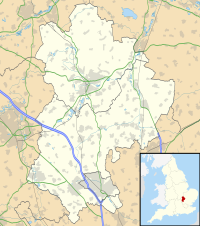
Flitwick Castle was an 11th-century castle located in the town of Flitwick, in the county of Bedfordshire, England.
It was a small, timber Motte-and-bailey castle, surrounded by a moat. The castle was mentioned in the Domesday Book, in 1086, as being under the ownership of William Lovet, a Norman. Lovet had displaced Alwin, who had been the Saxon owner of Flitwick prior to the Norman Conquest.[1]
The earthwork remains of the castle are on what is now a public green space known as Temple Field or Mount Hill. The ditches have been filled in and the mound is now about 7 m (20 ft) high.[2] The name Temple Field takes its name from the nearby church.[1] The site is a Scheduled Monument.
See also
[edit]References
[edit]- ^ a b "Flitwick Church History" (PDF). St Peter & St Paul with St Andrew Church, Flitwick. Archived from the original (PDF) on 3 March 2016. Retrieved 19 August 2012.
- ^ "Mount Hill Flitwick's Castle". BBC. Retrieved 19 August 2012.
External links
[edit]- Historic England. "The Mount: a motte and bailey castle (1010116)". National Heritage List for England. Retrieved 17 April 2019.
- English Heritage Monument No. 360080
51°59′51″N 0°30′19″W / 51.9975°N 0.5052°W

