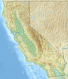
File:United States San Francisco Bay Area location map.svg
Appearance

Size of this PNG preview of this SVG file: 100 × 120 pixels. Other resolutions: 200 × 240 pixels | 400 × 480 pixels | 640 × 768 pixels | 853 × 1,024 pixels | 1,707 × 2,048 pixels.
Original file (SVG file, nominally 100 × 120 pixels, file size: 1.29 MB)
File history
Click on a date/time to view the file as it appeared at that time.
| Date/Time | Thumbnail | Dimensions | User | Comment | |
|---|---|---|---|---|---|
| current | 15:31, 27 October 2017 |  | 100 × 120 (1.29 MB) | Mliu92 | Fix visibility of small islands in North Bay |
| 15:28, 27 October 2017 |  | 100 × 120 (1.29 MB) | Mliu92 | User created page with UploadWizard |
File usage
The following 80 pages use this file:
- 1984 Summer Olympics torch relay
- Alameda (island)
- Alcatraz Island
- Angel Island (California)
- Aramburu Island
- Bair Island
- Bay Farm Island, Alameda, California
- Belmont Slough
- Belvedere Island
- Berkeley, California
- Bird Island (Marin County, California)
- Bird Island (San Mateo County, California)
- Brewer Island
- Brooks Island Regional Preserve
- Bull Island (California)
- Burdell Island
- Castro Rocks
- Coast Guard Island
- Colma, California
- Coon Island (California)
- Corinthian Island
- Day Island (California)
- Deer Island (Marin County)
- Ecology of the San Francisco Estuary
- Edgerly Island
- Emeryville Crescent State Marine Reserve
- Farallon Islands
- Fort Barry
- Greco Island
- Green Island (California)
- Grizzly Bay
- Gull Rock
- Hog Island (Petaluma River)
- Hog Island (Tomales Bay)
- Hooks Island
- Hydrography of the San Francisco Bay Area
- Island No. 1
- Island No. 2
- Jakes Island
- Kent Island (California)
- Knight Island (California)
- List of islands of California
- Little Island (California)
- Mare Island
- Marin Islands
- Marsh Creek (California)
- Mills Creek (San Mateo County)
- Montara Mountain
- Mount Davidson (California)
- Mussel Rock
- Neils Island
- Ogilvie Island
- Purisima Creek Redwoods Open Space Preserve
- Rat Rock (California)
- Red Rock Island
- Richardson Bay
- Richardson Island
- Russ Island
- San Bruno Mountain
- San Pedro Rock
- Seal Rock (San Mateo County, California)
- Seal Rocks (San Francisco, California)
- Silva Island
- Simms Island
- Skaggs Island Naval Communication Station
- Sports in the San Francisco Bay Area
- Suisun Bay
- Sunset Reservoir
- The Brothers (San Francisco Bay)
- The Sisters (California)
- Treasure Island, San Francisco
- Tubbs Island
- Wood Island (Marin County)
- Yerba Buena Island
- User:JPxG
- Template:Islands of the San Francisco Bay Area
- Module:Location map/data/USA San Francisco Bay Area
- Module:Location map/data/USA San Francisco Bay Area/doc
- Module:Location map/data/United States San Francisco Bay Area
- Module:Location map/data/United States San Francisco Bay Area/doc
Global file usage
The following other wikis use this file:
- Usage on fr.wikipedia.org
- Usage on ja.wikipedia.org
- Usage on os.wikipedia.org
- Usage on simple.wikipedia.org
- Usage on si.wikipedia.org
- Usage on th.wikipedia.org
- Usage on uz.wikipedia.org
- Usage on zh.wikipedia.org


