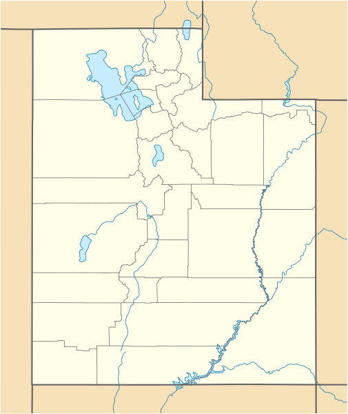
File:USA Utah location map.svg
Appearance

Size of this PNG preview of this SVG file: 505 × 600 pixels. Other resolutions: 202 × 240 pixels | 404 × 480 pixels | 647 × 768 pixels | 862 × 1,024 pixels | 1,724 × 2,048 pixels | 868 × 1,031 pixels.
Original file (SVG file, nominally 868 × 1,031 pixels, file size: 175 KB)
File history
Click on a date/time to view the file as it appeared at that time.
| Date/Time | Thumbnail | Dimensions | User | Comment | |
|---|---|---|---|---|---|
| current | 15:34, 15 June 2015 |  | 868 × 1,031 (175 KB) | NordNordWest | Reverted to version as of 12:08, 12 December 2010; please upload it as a new file |
| 14:48, 15 June 2015 |  | 868 × 1,031 (289 KB) | Prinsgezinde | Reverted to version as of 14:44, 15 June 2015 | |
| 14:47, 15 June 2015 |  | 868 × 1,031 (289 KB) | Prinsgezinde | As per revert | |
| 14:44, 15 June 2015 |  | 868 × 1,031 (289 KB) | Prinsgezinde | Reverted to version as of 06:39, 12 December 2010 - Unhelpful revert, change was requested and is appreciated | |
| 12:08, 12 December 2010 |  | 868 × 1,031 (175 KB) | NordNordWest | no discussion, no change | |
| 06:39, 12 December 2010 |  | 868 × 1,031 (289 KB) | Moabdave | Added inset to show location of Utah. Inset derived from File:Map_of_USA_UT.svg. Change made per request at FAC for en:Thistle Utah. | |
| 18:09, 9 June 2009 |  | 868 × 1,031 (175 KB) | NordNordWest | {{Information |Description= {{de|Positionskarte von Utah, USA}} Quadratische Plattkarte, N-S-Streckung 125 %. Geographische Begrenzung der Karte: * N: 42.4° N * S: 36.6° N * W: 114.6° W * O: 108.5° W {{en|Location map of [[:en |
File usage
More than 100 pages use this file. The following list shows the first 100 pages that use this file only. A full list is available.
- Alfred McCune Home
- Altamont, Utah
- American Fork, Utah
- Apple Valley, Utah
- Aurora, Utah
- Balanced Rock
- Bear River Migratory Bird Refuge
- Beaver, Utah
- Beryl, Utah
- Big Cottonwood Canyon
- Bigelow-Ben Lomond Hotel
- Bingham Canyon Mine
- Bonneville Salt Flats
- Bonneville Speedway
- Bountiful Utah Temple
- Camp Floyd State Park Museum
- Canyon Rim, Utah
- Cathedral of the Madeleine
- Cedar City Regional Airport
- Church Rock (Utah)
- Cisco, Utah
- Cottonwood Paper Mill
- Cove Fort
- Crystal Geyser
- Dead Horse Point State Park
- Delicate Arch
- Desert Biosphere Reserve
- Desert Star Theater
- Double Arch (Utah)
- Draper Utah Temple
- Eccles Avenue Historic District
- Emigration Canyon, Utah
- Escalante Desert
- EskDale, Utah
- Eureka, Utah
- Fillmore, Utah
- Fort Douglas
- Fry Canyon, Utah
- Goulding's Lodge
- Grandstaff Canyon
- Great Salt Lake Desert
- Grosvenor Arch
- Hamiltons Fort, Utah
- Hiawatha, Utah
- Holladay, Utah
- Holy Trinity Cathedral (Salt Lake City)
- Iosepa, Utah
- Jefferson Avenue Historic District (Ogden, Utah)
- John Moses Browning House
- John Williams Gunnison
- Jordan River Utah Temple
- Joseph Smith Memorial Building
- Jurassic National Monument
- Keetley, Utah
- Kolob Arch
- Landscape Arch
- List of Utah State Parks
- Little Sahara Recreation Area
- Logan Utah Temple
- Lucin Cutoff
- Lund, Utah
- Maeser Elementary
- Manti Utah Temple
- Monticello Utah Temple
- Mount Carmel Junction, Utah
- Mount Pleasant, Utah
- Mount Timpanogos Utah Temple
- Mountain Meadows Massacre
- Murray Theater (Murray, Utah)
- Natural Bridges National Monument
- Ogden Utah Temple
- Partoun, Utah
- Promontory Point (Utah)
- Provo Utah Temple
- Red Butte Garden and Arboretum
- Rush Valley
- Salt Lake City Council Hall
- Salt Lake City Union Pacific Depot
- Salt Lake City and County Building
- Salt Lake Temple
- Saltair (Utah)
- Sipapu Bridge
- Spring City, Utah
- Springville Museum of Art
- Stimper Arch
- Temple Square
- The Avenues, Salt Lake City
- The Subway (Zion National Park)
- Thistle, Utah
- Tintic Standard Reduction Mill
- Union Station (Ogden, Utah)
- Upheaval Dome
- Utah System of Higher Education
- Utah Territorial Statehouse
- Vernal Utah Temple
- Wasatch Academy
- Wendover Air Force Base
- Westwater Canyon
- Wilson Arch
- Woodland, Utah
View more links to this file.
Global file usage
The following other wikis use this file:
- Usage on an.wikipedia.org
- Usage on ar.wikipedia.org
- Usage on ast.wikipedia.org
- Usage on azb.wikipedia.org
- کانیون ریم
- ولف کریک، یوتا
- اقنوق، یوتا
- بالفراق، یوتا
- بریل، یوتا
- داک کریک ویلج، یوتا
- لاپوینت، یوتا
- ماونت کارمل جانکشن، یوتا
- اسکدیل، یوتا
- باربانک، یوتا
- مودنا، یوتا
- لاند، یوتا
- قروور، یوتا
- بلومینقتون، یوتا
- کرویدون، یوتا
- وست وبر، یوتا
- قرینویل، یوتا
- کالاو، یوتا
- آدامزویل، یوتا
- مونتاین هوم، یوتا
- آجاکس، یوتا
- واهساچ، یوتا
- تالمئیج، یوتا
- آلتامونت، یوتا
- وارن، یوتا
- واشاکی، یوتا
- آلتوناه، یوتا
- ترئیس، یوتا
- آلونیت، یوتا
- آمریکان فورک، یوتا
- تیکابو، یوتا
- آپل والئی، یوتا
- ورای، یوتا
- آورورا، یوتا
- آکستل، یوتا
- امیقراشن کانیون، یوتا
- پارک والئی، یوتا
- پارتون، یوتا
- تریدل، یوتا
- تروت کریک، یوتا
- وزت والئی سیتی، یوتا
- پنروز، یوتا
- توکر، یوتا
- پترزون، یوتا
View more global usage of this file.


