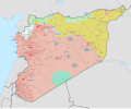
File:Syrian, Iraqi, and Lebanese insurgencies.svg
Appearance

Size of this PNG preview of this SVG file: 794 × 599 pixels. Other resolutions: 318 × 240 pixels | 636 × 480 pixels | 1,018 × 768 pixels | 1,280 × 966 pixels | 2,560 × 1,932 pixels | 1,538 × 1,161 pixels.
Original file (SVG file, nominally 1,538 × 1,161 pixels, file size: 4.83 MB)
File history
Click on a date/time to view the file as it appeared at that time.
| Date/Time | Thumbnail | Dimensions | User | Comment | |
|---|---|---|---|---|---|
| current | 23:42, 31 January 2024 |  | 1,538 × 1,161 (4.83 MB) | Ecrusized | Fixes |
| 22:35, 31 January 2024 |  | 1,538 × 1,161 (4.85 MB) | Ecrusized | Fixes | |
| 22:12, 31 January 2024 |  | 1,538 × 1,161 (4.88 MB) | Ecrusized | Uploaded own work with UploadWizard |
File usage
The following 12 pages use this file:
- Hezbollah involvement in the Syrian civil war
- History of Iraq (2011–present)
- Iranian intervention in Iraq (2014–present)
- Kurdistan
- List of wars and battles involving the Islamic State
- Rojava–Kurdistan Region relations
- Spillover of the Syrian civil war
- Timeline of the Islamic State (2016)
- Timeline of the War in Iraq (2014)
- War against the Islamic State
- Talk:List of ongoing armed conflicts
- Template:International military intervention against the Islamic State infobox
Global file usage
The following other wikis use this file:
- Usage on als.wikipedia.org
- Usage on am.wikipedia.org
- Usage on ar.wikipedia.org
- العراق
- تنظيم الدولة الإسلامية (داعش)
- تدخل حزب الله في الحرب الأهلية السورية
- التدخل الإيراني في العراق (2014–الآن)
- بوابة:تنظيم الدولة الإسلامية (داعش)/صورة مختارة/أرشيف
- بوابة:تنظيم الدولة الإسلامية (داعش)/صورة مختارة/1
- قائمة الحروب والمعارك التي تشمل تنظيم الدولة الإسلامية (داعش)
- تداعيات الحرب الأهلية السورية
- الخط الزمني للأحداث المتعلقة بداعش (2016)
- التدخل العسكري الدولي ضد تنظيم الدولة الإسلامية (داعش)
- Usage on arz.wikipedia.org
- Usage on ast.wikipedia.org
- Usage on azb.wikipedia.org
- Usage on bcl.wikipedia.org
- Usage on be-tarask.wikipedia.org
- Usage on be.wikipedia.org
- Usage on bg.wikipedia.org
- Usage on bn.wikipedia.org
- Usage on br.wikipedia.org
- Usage on ce.wikipedia.org
- Usage on ckb.wikipedia.org
- Usage on cs.wikipedia.org
- Usage on cy.wikipedia.org
- Usage on da.wikipedia.org
- Usage on de.wikipedia.org
- Usage on de.wikinews.org
- Usage on diq.wikipedia.org
- Usage on el.wikipedia.org
- Usage on es.wikipedia.org
- Usage on et.wikipedia.org
- Usage on fa.wikipedia.org
- Usage on fi.wikipedia.org
- Usage on fo.wikipedia.org
- Usage on fr.wikipedia.org
- Usage on fr.wikinews.org
- Usage on ha.wikipedia.org
- Usage on he.wikipedia.org
- Usage on hi.wikipedia.org
- Usage on hu.wikipedia.org
View more global usage of this file.


