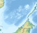
File:Spratly Islands relief location map.svg
Appearance

Size of this PNG preview of this SVG file: 671 × 599 pixels. Other resolutions: 269 × 240 pixels | 538 × 480 pixels | 860 × 768 pixels | 1,147 × 1,024 pixels | 2,293 × 2,048 pixels | 720 × 643 pixels.
Original file (SVG file, nominally 720 × 643 pixels, file size: 2.23 MB)
File history
Click on a date/time to view the file as it appeared at that time.
| Date/Time | Thumbnail | Dimensions | User | Comment | |
|---|---|---|---|---|---|
| current | 08:47, 17 October 2020 |  | 720 × 643 (2.23 MB) | LuciferAhriman | Uploaded own work with UploadWizard |
File usage
The following 63 pages use this file:
- Alison Reef
- Amboyna Cay
- Ardasier Reef
- Barque Canada Reef
- Bombay Castle (South China Sea)
- Central London Reef
- Collins Reef
- Commodore Reef
- Cornwallis South Reef
- Cuarteron Reef
- Dallas Reef
- Discovery Great Reef
- East London Reef
- Eldad Reef
- Erica Reef
- Fiery Cross Reef
- First Thomas Shoal
- Flat Island (South China Sea)
- Gaven Reefs
- Grierson Reef
- Half Moon Shoal
- Hughes Reef
- Investigator Shoal
- Irving Reef
- James Shoal
- Johnson South Reef
- Ladd Reef
- Lankiam Cay
- Lansdowne Reef
- Loaita Cay
- Loaita Island
- Loaita Nan
- Louisa Reef
- Mariveles Reef
- Mischief Reef
- Namyit Island
- Nanshan Island
- North Danger Reef
- Northeast Cay
- Northeast Investigator Shoal
- Pearson Reef
- Petley Reef
- Royal Captain Shoal
- Sabina Shoal
- Sand Cay
- Second Thomas Shoal
- Sin Cowe Island
- South Reef
- Southwest Cay
- Spratly Island
- Subi Reef
- Swallow Reef
- Taiping Island
- Tennent Reef
- Third Thomas Shoal
- Thitu Island
- West London Reef
- West York Island
- Western Reef
- Zhongzhou Reef
- File talk:Spratly Islands relief location map.svg
- Module:Location map/data/Spratly Islands relief
- Module:Location map/data/Spratly Islands relief/doc
Global file usage
The following other wikis use this file:
- Usage on bcl.wikipedia.org
- Usage on fr.wikipedia.org
- Usage on ms.wikipedia.org
- Usage on si.wikipedia.org
- Usage on uk.wikipedia.org
- Usage on uz.wikipedia.org
- Usage on zh.wikipedia.org
- 曾母暗沙
- 郑和群礁
- 拉央拉央岛
- 烏比礁
- 西布礁
- 曼丹那尼礁
- 大森馬朗西礁
- 柏宁照礁
- 奥援暗沙
- 拉雅礁
- 北外沙洲
- 拉惹加隆暗沙群
- 仁答暗沙
- 拿督兰底礁
- 阿顺礁
- 宁宜礁
- 柏迈苏丽礁
- 里东礁
- 大渊滩
- 当阿惹破礁
- 郎银当礁
- 巴丁宜阿里暗沙群
- 拿督打立礁
- 沙合礁
- 班丁破礁
- 萬年煙礁
- 沙吉礁
- 峇都布爹礁
- 美巴蒂暗沙
- Template:Location map Spratly Islands
- Template:Location map Spratly Islands relief
- Module:Location map/data/Spratly Islands
- Module:Location map/data/Spratly Islands relief
- Module:Location map/data/Spratly Islands/doc
- Module:Location map/data/Spratly Islands relief/doc
View more global usage of this file.

